Tasmania
Trip February 2013
During our 'Round the World' trip
in 2010, I learned about the ongoing Greenhill
Observatory project for the University of Tasmania. This was to
install a 1.27 metre telescope at a dark site in central Tasmania to
replace the light polluted 1 metre telescope at Mount Canopus,
Hobart. I made a modest donation, and was kept informed of progress
through the University system. In November 2012 I received an
invitation to attend the official opening on February 23rd 2013. A
long way to go, but with my wife's Sister living in Tas (and her
birthday on 22nd!) and a wish to further image the Southern night sky
it was go! (All thumbnail photos are linked to larger ones. Some
browsers will show a border, but anyway just click on the thumbnail
to see the larger photo).
|
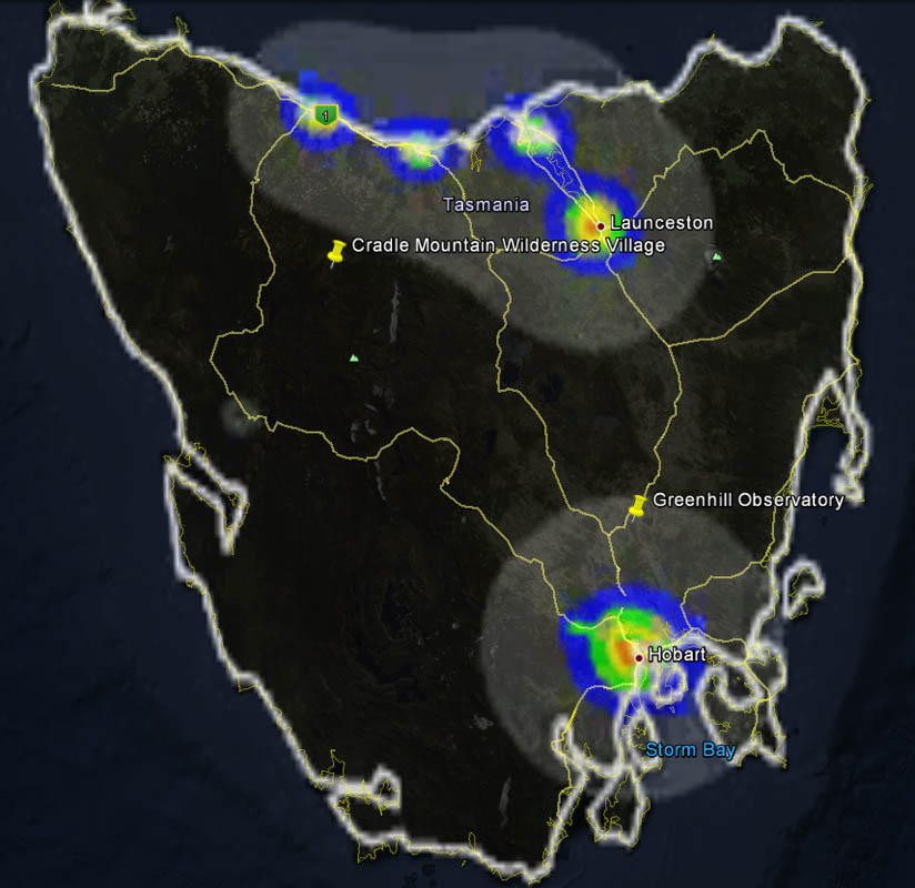
We arrived in Tasmania at Hobart airport on 13th
February, collected our hire car, and the next day travelled
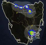
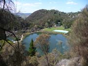
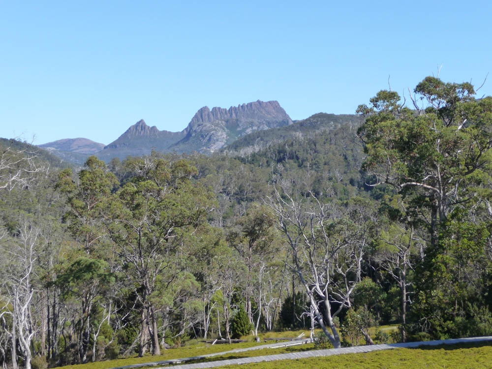
up to the Cradle Mountain area. This wilderness National
Park is a prime tourist location, well served with
accommodation but with virtually zero light pollution, even
darker than the Observatory site, and at 3000 feet altitude
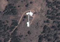
a prime candidate for astrophotography. This Google Earth
light pollution map clearly shows the potential of Tasmania
skies. With only half a million population much of Tasmania
is uninhabited and vast areas of wilderness are protected as
National
Parks.
|
|
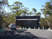
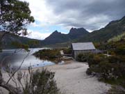
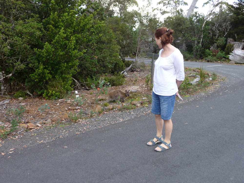
For the Cradle Mountain area we stayed at the Wilderness
Village. Beautifully located just above the National Park Visitor
Centre among unspoilt forest. Our chalet was new this year and very
well appointed. As soon as we arrived, remarkably unafraid wildlife
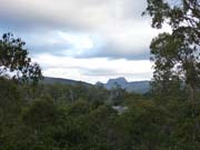
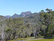
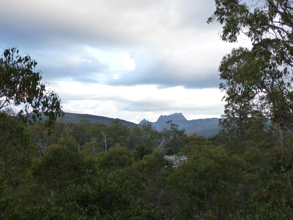
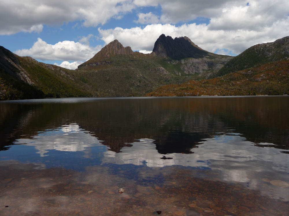
was in evidence! We had our first view of the iconic Cradle Mountain
from the village reception area, but after the long drive from Hobart
(and remaining jet lag!) called it a day. The next day we went to the
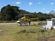
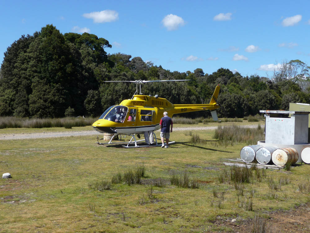
Visitor Centre to start exploring the area, and before you could say
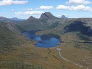
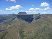
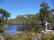
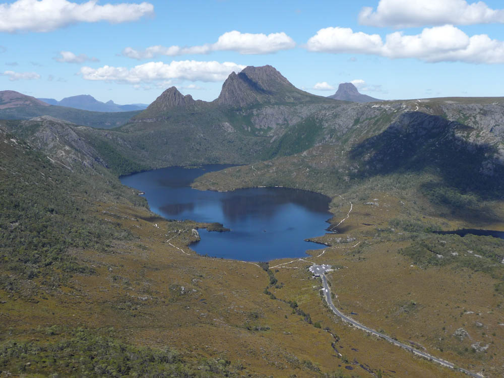
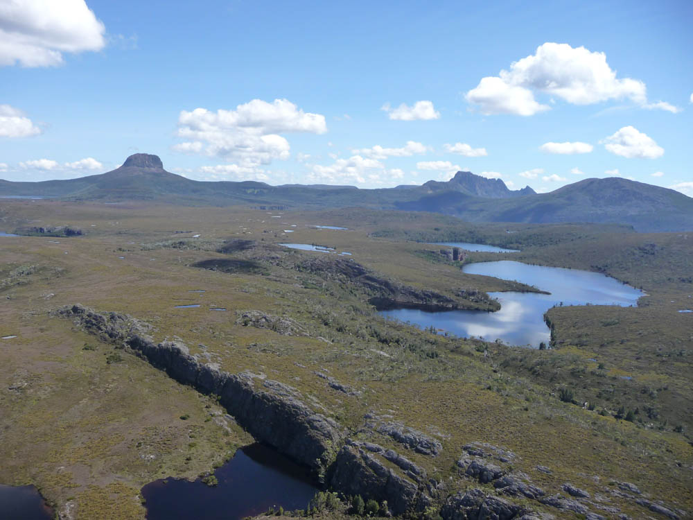
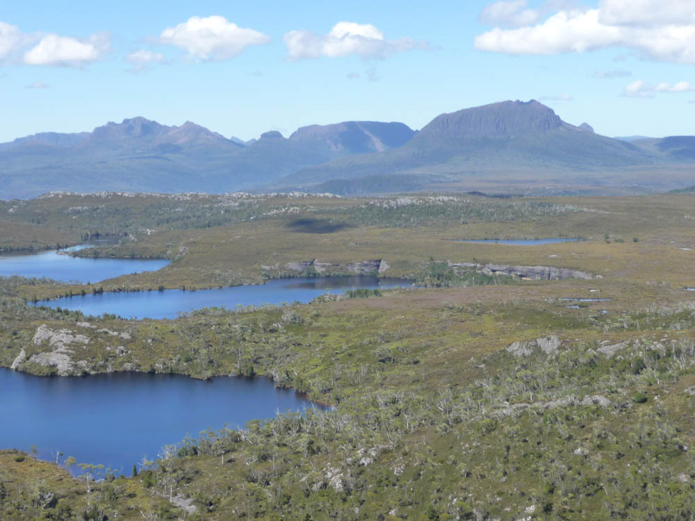
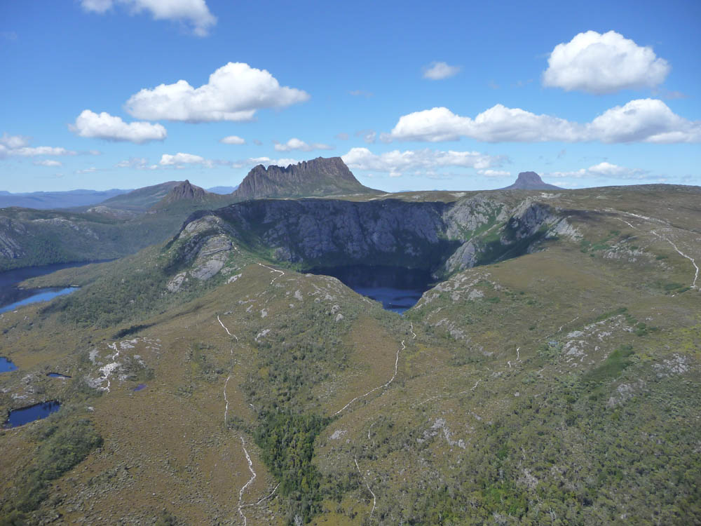
Cradle Mountain we were in a helicopter for a superb ride around the
area! Wonderful views of the mountain and Dove Lake and the rugged
and mountainous back country. An excellent view of Crater Lake. After
the flight we travelled up to Dove Lake using the transfer bus and
enjoyed a walk around the lake. Cradle Mountain rises to 5069 feet
above sea level, but because the lake is 3065 feet ASL, the true
height of the mountain is not so apparent.

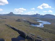


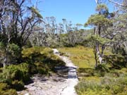
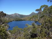
Now we had found our way around the area we spent the remaining
three days enjoying the many and varied walks in the beautiful
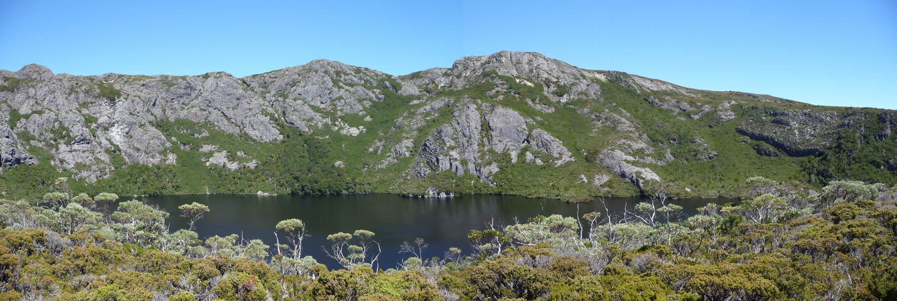
valley. Crater Lake circuit was a superb walk. A delightful climb
through woodland to the lake itself at 3400 feet above sea level with
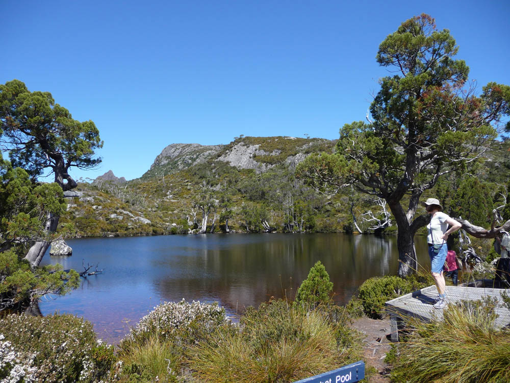
the wall behind rising to 4167 ft. Wombat Pool was charming with the
densest population of tadpoles I have ever seen! A serene Lake Lilla
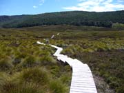
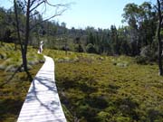
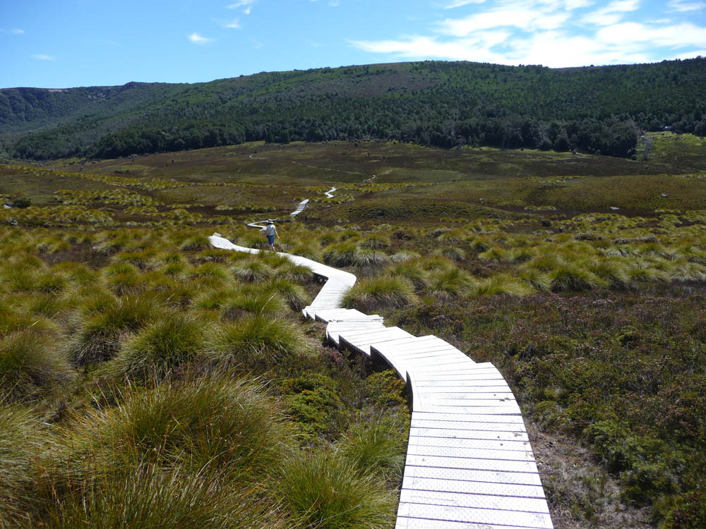
with Dove Lake just visible behind. Then a long stretch of boardwalk
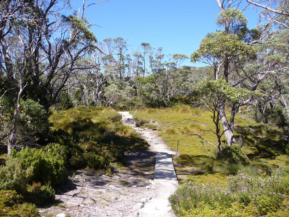
leading back to the bus stop at Ronny Creek. The more readily
accessible areas are extensively linked by several miles of well
constructed boardwalk to minimise erosion and protect the sensitive
alpine flora.

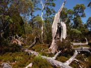
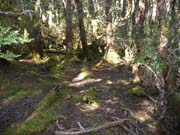
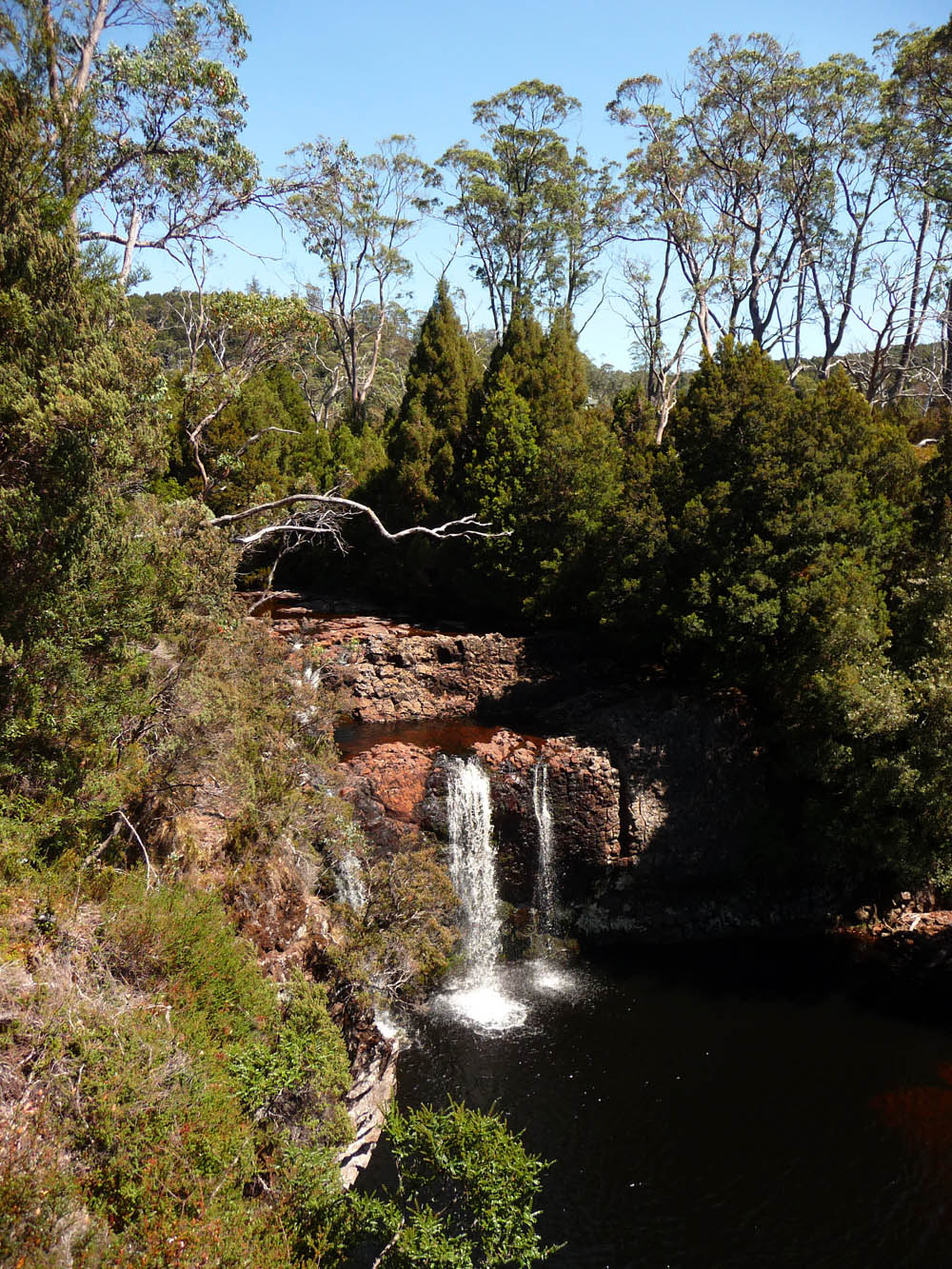
The weather had been very dry, leading to extensive brush fires in
the South a few weeks before we arrived, so the waterfalls in the
area gave only an indication of what they could look like in wet
weather. But the settings were beautiful! Pencil Pine Falls are
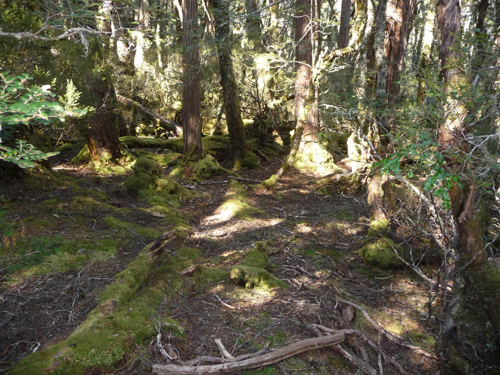
situated in rich ancient woodland as are Knyvet Falls, both only a
short walk from the Ranger Centre. The long (4 mile) boardwalk
between Ronny Creek and the Ranger Station passed through varying
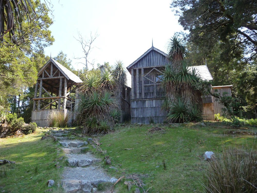
countryside with beautiful views. The area was originally settled by
Gustav
Weindorfer at the beginning of the 20th century. He tirelessly
promoted the area and was instrumental in it gaining National Park
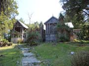
status. A replica of his 'Waldheim' cabin was very interesting, and
surrounded again by ancient woodland.
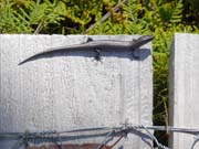
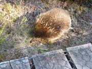
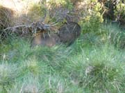
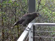
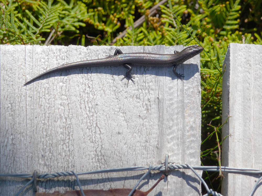
During our walks we saw a variety of wildlife. Grass Skink lizards
were often seen basking on the boardwalks, indeed we had to be
careful not to step on them,although usually they were quick to dive
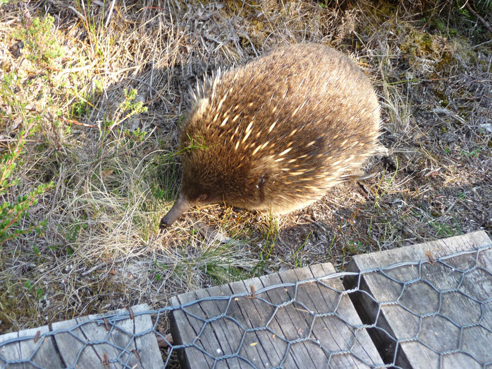
under the boards and hide! Less nervous was this Echidna which
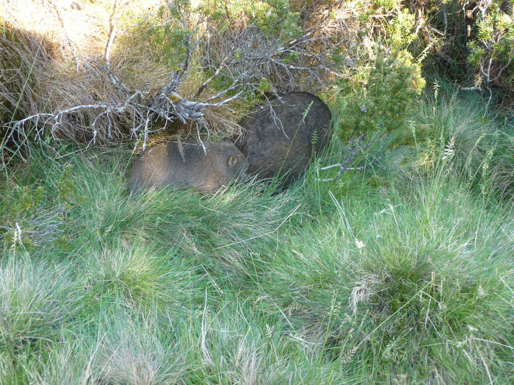
happily foraged only a couple of feet away. The mother Wombat and
Joey, unusually out in the daytime, kept to the long grass. The
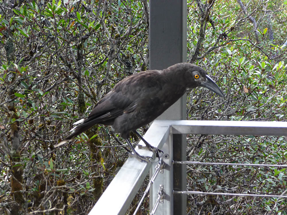
handsome, noisy and ubiquitous Currawong Australian Raven was very
much in evidence, not only in most of the woodland but also around
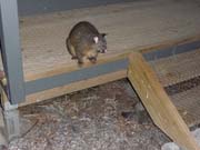
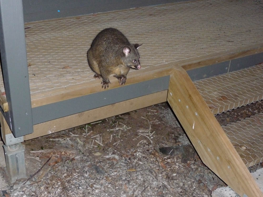
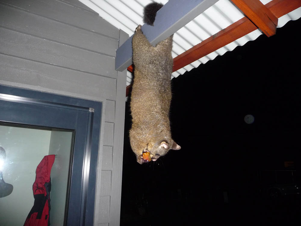
our chalet. And the Brush Tail Possum made itself at home, enjoying a
somewhat overripe plum on this occasion. A frequent visitor to our
chalet it was quite unafraid and once it got to know me not only
climbed on my knee but even explored the inside of our car! One
evening it turned up with a Joey, unfortunately no photo. Generally
considered a pest, but on this occasion quite delightful.

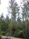
I had hoped to do lots of astrophotography while at the Cradle
Mountain area. The (14th February) evening of our arrival there was
beautifully clear at first although it clouded over later, but with
the jet lag and long drive from Hobart I was too shattered to do
other than admire the view, and there was nowhere near our chalet
with open enough sky. The next day the site warden suggested I use
the Visitor Centre car park which was free and open 24 hours. Sure
enough it was eminently suitable. But read on:
|
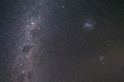
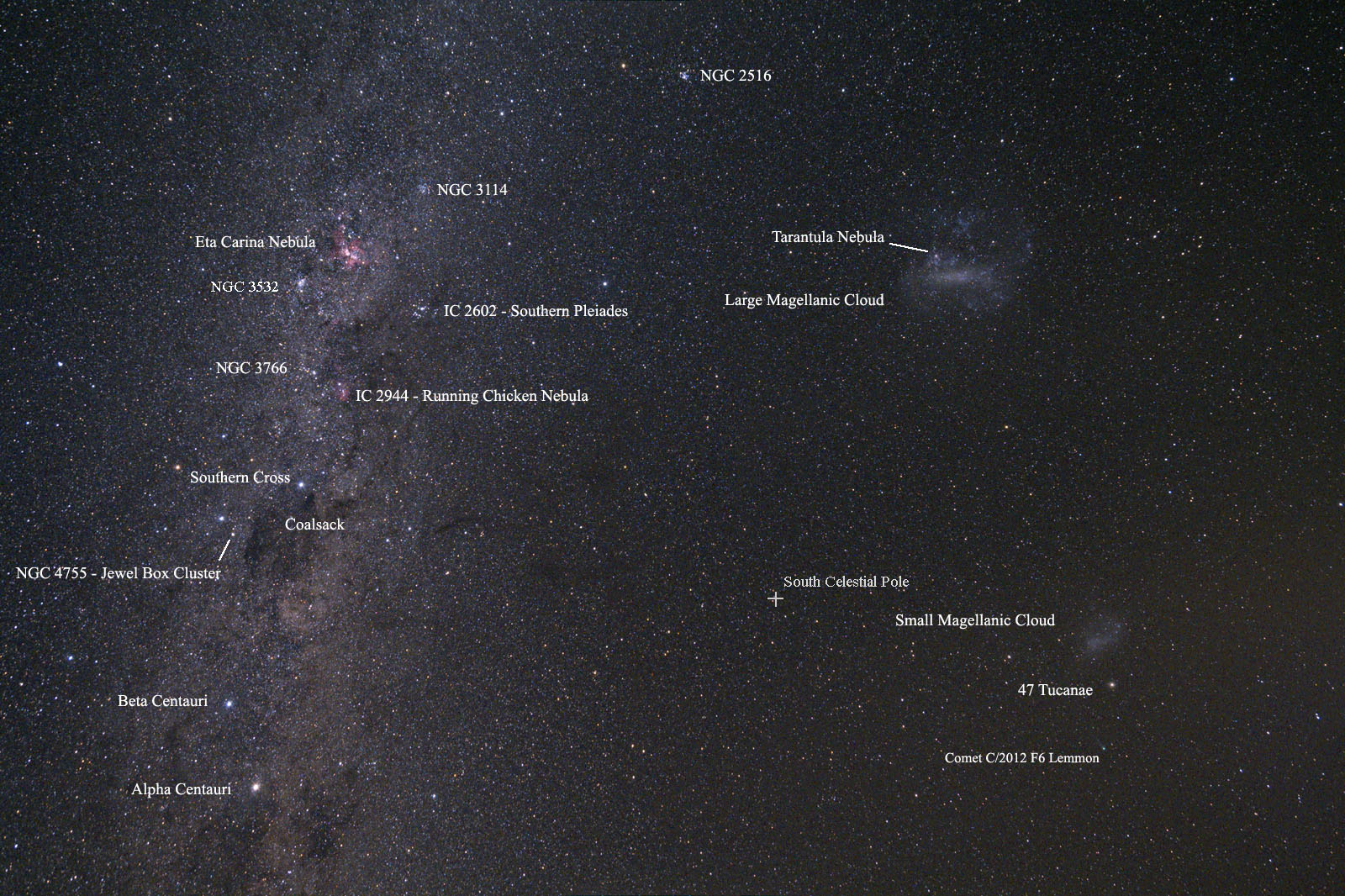
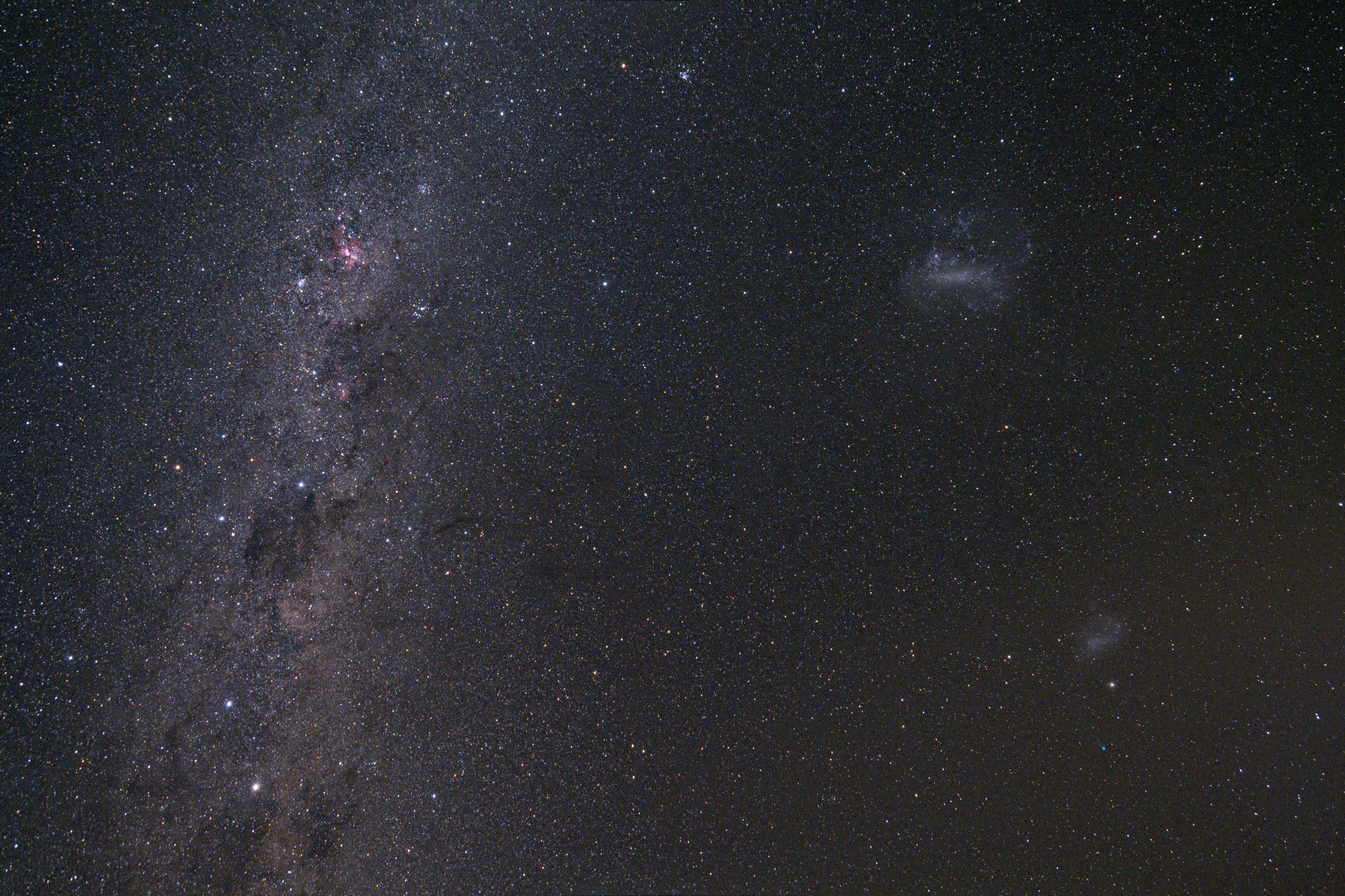
Alas the weather was unkind - despite wall to wall
sunshine during the day, every evening it clouded over after
Sunset. I only managed 2 frames under clear skies one
evening and this is the result. 15th February, 2 x 10
minutes (and the second started to cloud over half way
through - just visible as a haze around the Small Magellanic
Cloud) using my Canon 350D and Tamron 17-50 mm f2.8 zoom
lens at 17 mm, f5.6 and ISO800. Unguided on my
EQ3-2 mount. The medium size image (click on the
thumbnail) has 'mouseover' names for several objects. Larger
image with names here.
(I didn't notice the comet near the Small MagellanicCloud
until June 2013!)
This image appeared in the August 2013
issue of Sky at Night magazine.
Full Size (2.1
MB!)
|
|
|
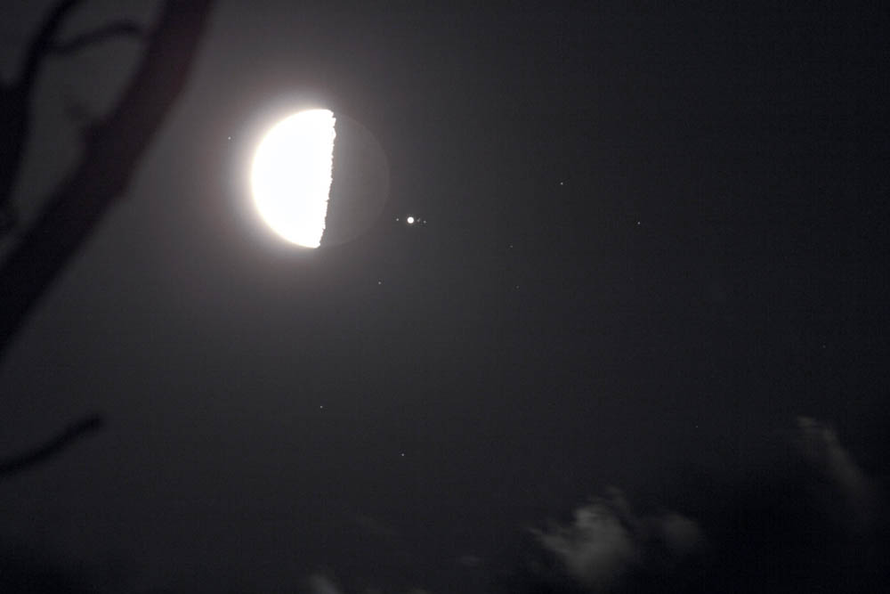
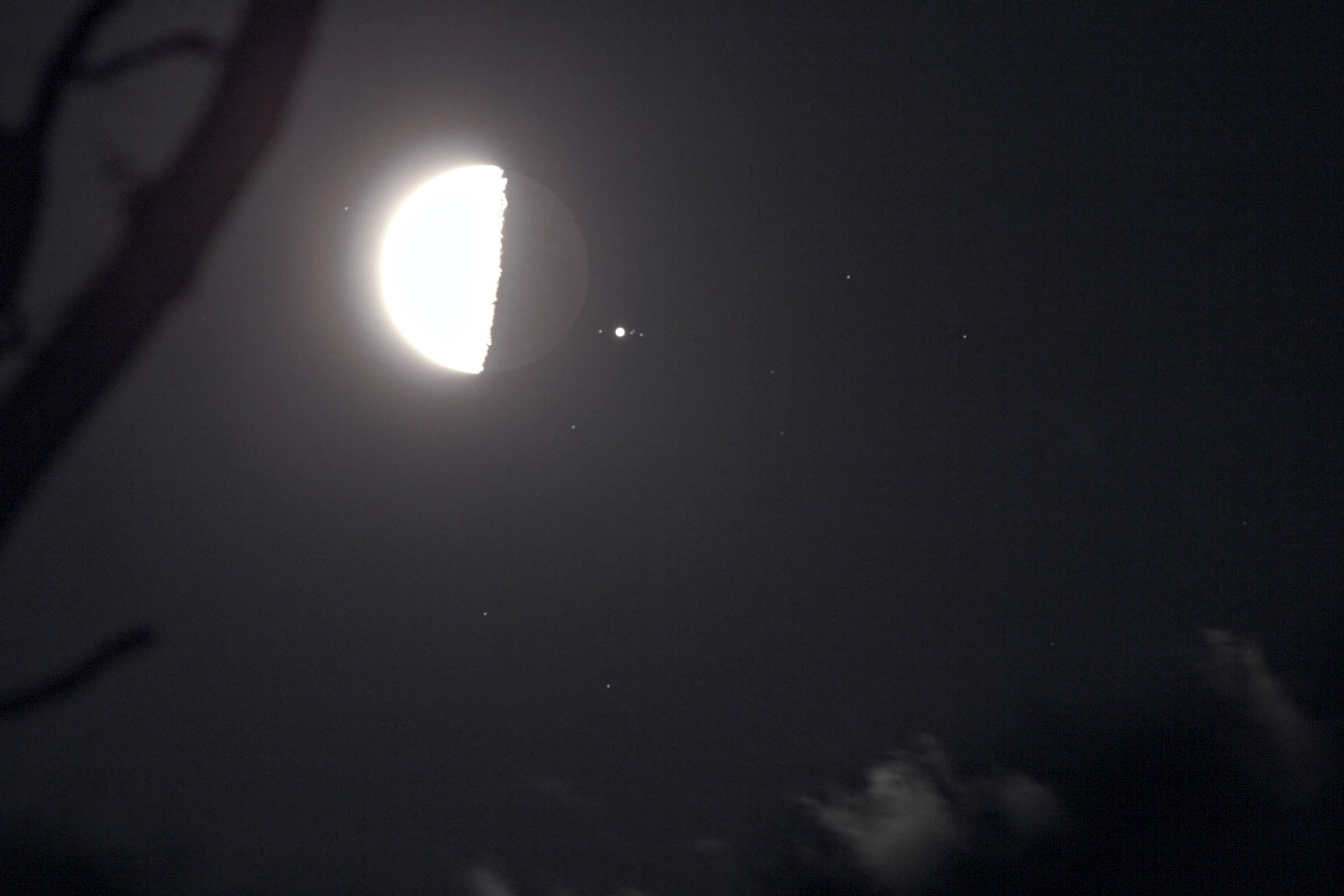
On 18th February there was an occultation of Jupiter by
the Moon. Not visible in the UK, but I managed to observe
and capture it from our location despite tree branches and
clouds. I had to keep moving the mount to avoid branches,
and unfortunately the focus shifted slightly so the field
stars and moons of Jupiter are not the pinpoints of earlier
but partially obscured attempts. But worth keeping! Canon
350D with Canon 400L Lens, single 2 second exposure at f5.6
and ISO 100. Just enough Earthshine to see the unlit part of
the Moon. The star which has emerged from Occultation (top
left) is 5th magnitude Omega Tauri.
This image appeared in the April 2013
issue of Astronomy Now magazine.
Full
Size
|

|
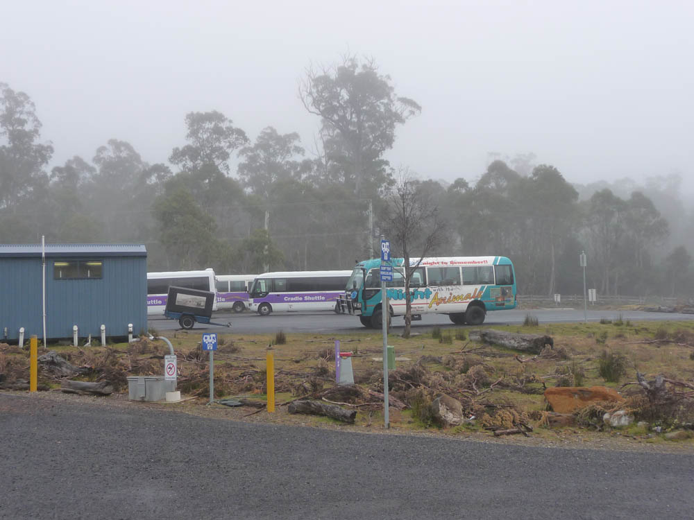
The cloudy nights were a major disappointment, but tempered by the
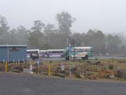
beautiful daytime weather. The last night it actually started to rain
just after I set up, and the morning of our departure dawned very
misty - not much fun for those intending to walk that day! The
shuttle buses were all lined up ready for their daily trips to Dove
Lake, but not for us! However the Sun did burn through later, and we
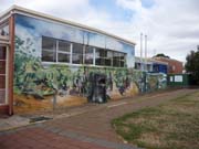
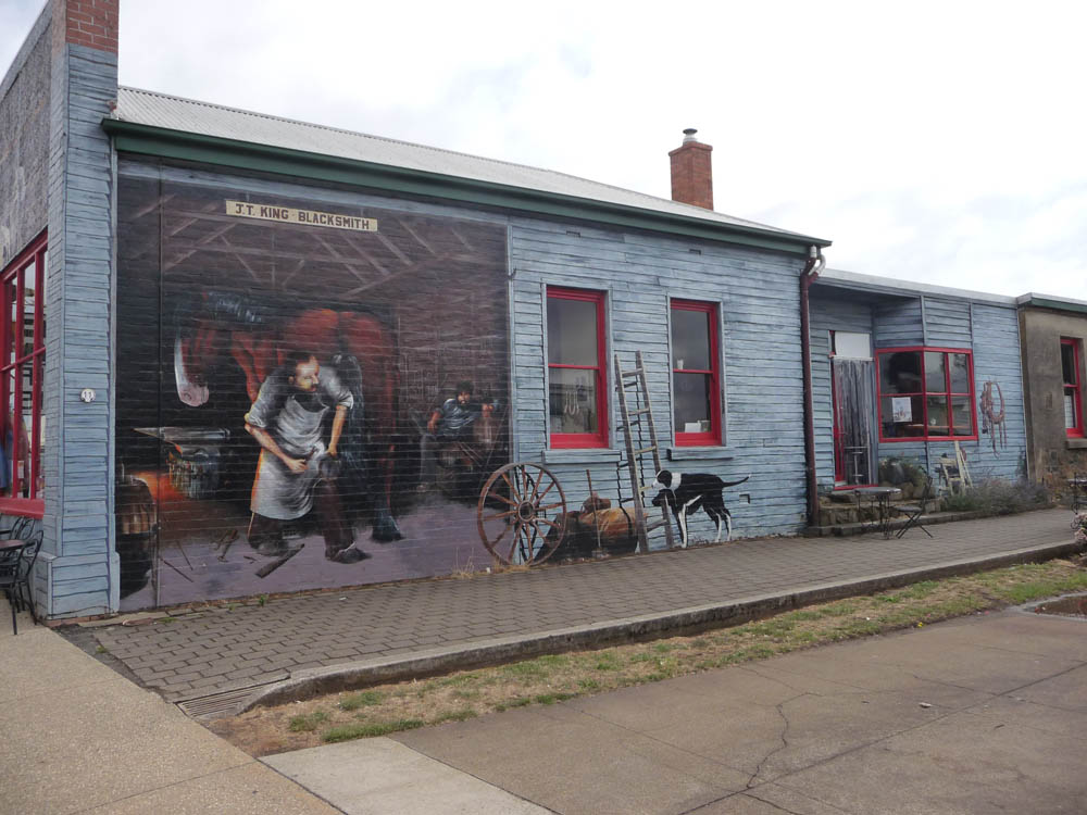
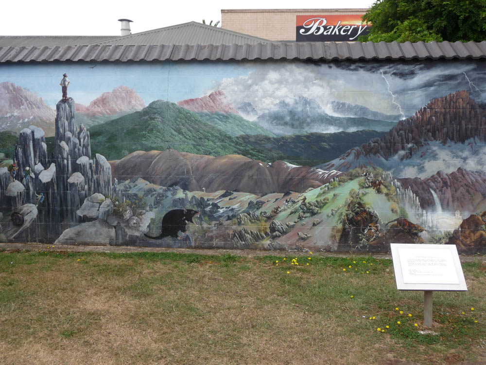
enjoyed a stop over in the interesting small town of Sheffield,
famous for its murals. A small selection here.


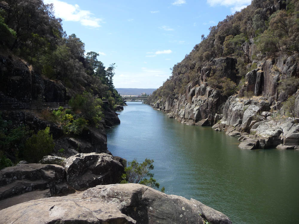
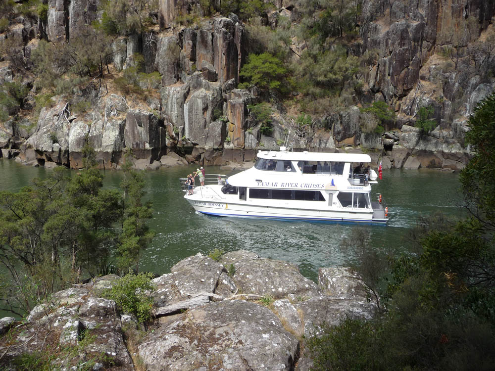
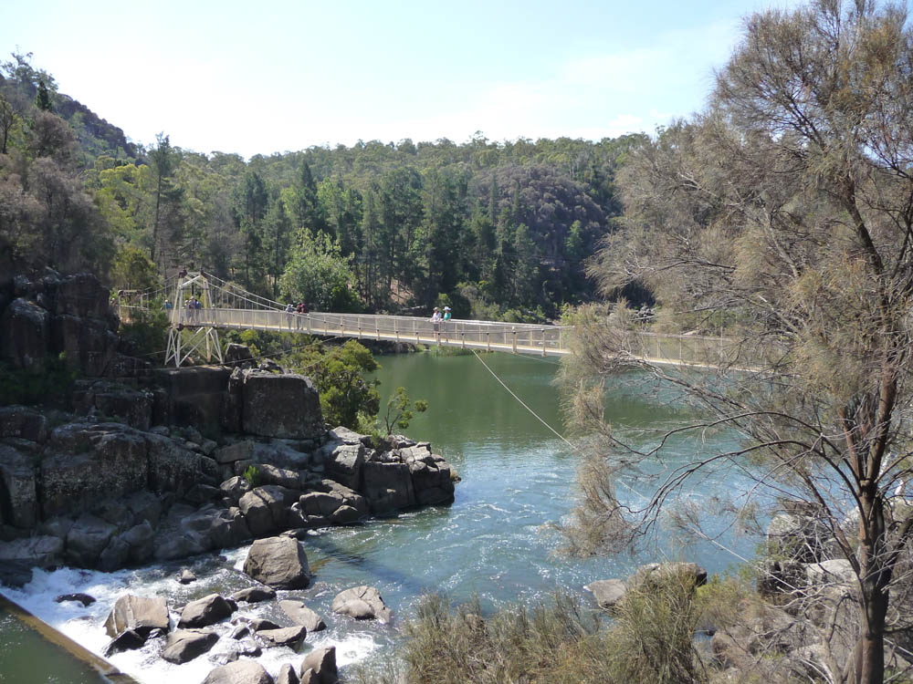
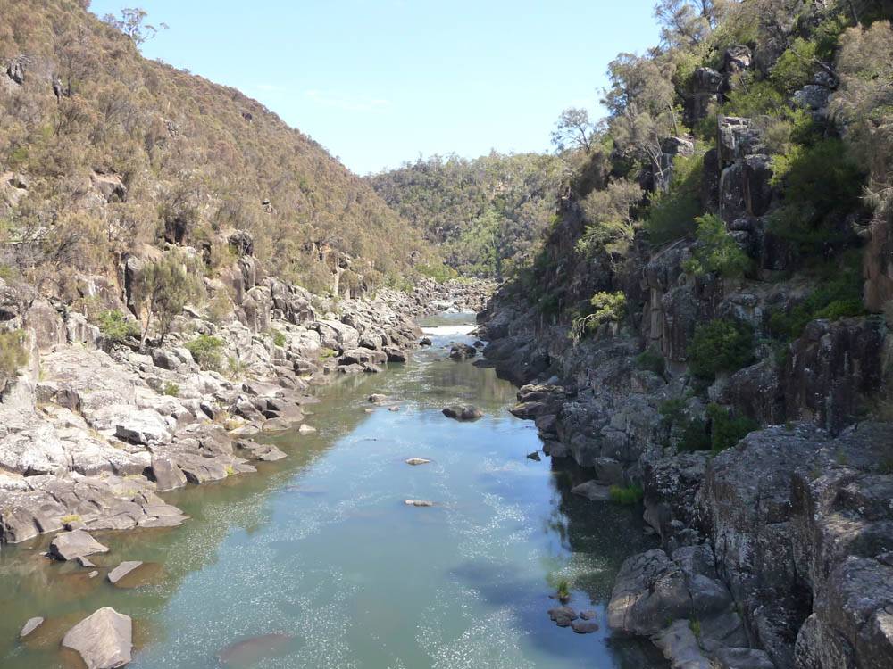
We moved on to our relations near Launceston and stayed with them
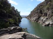
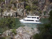
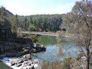
for a few nights. Cataract
Gorge in Launceston is a famous area, amazingly close to the town
centre and we enjoyed a walk there, in the hot sunshine. River
cruises go part way up until the area of rapids. This house perched
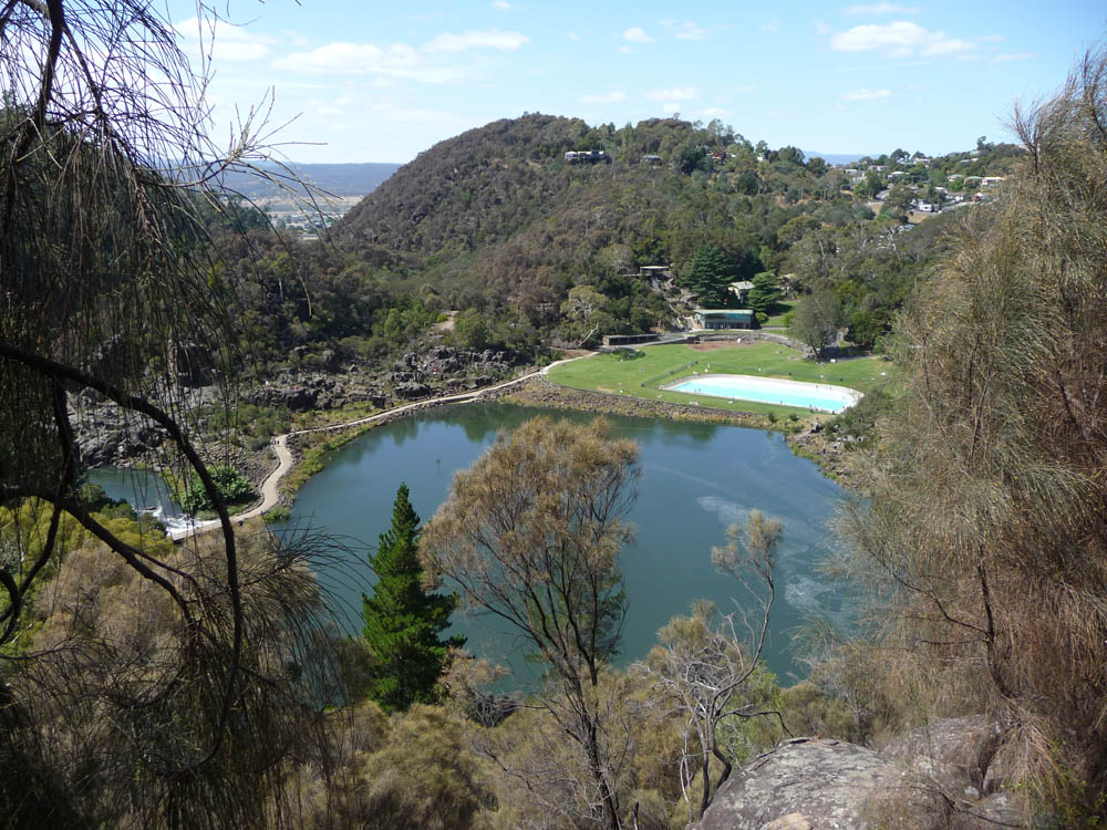
high on the hillside looks at first as though it can only be reached
by helicopter! But all is revealed when the gorge opens out to a
leisure area complete with cafes and a swimming pool, both sides
linked by a bridge and causeway. The gorge continues and a full day's
walk is possible. Too hot for us that day! Again due to the dry
weather not much water coming down. But
floods in the past have completely inundated the leisure
area.

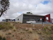
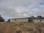
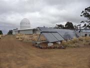
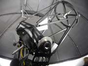
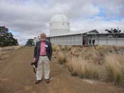
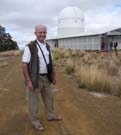
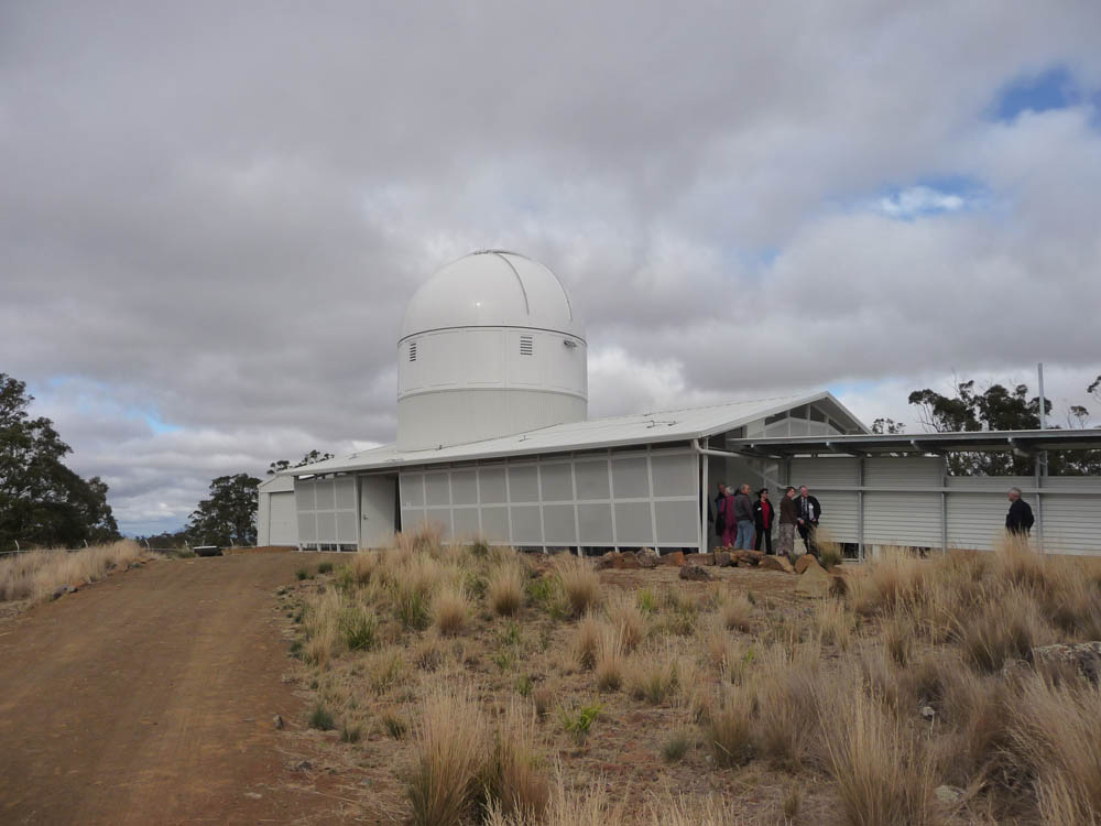
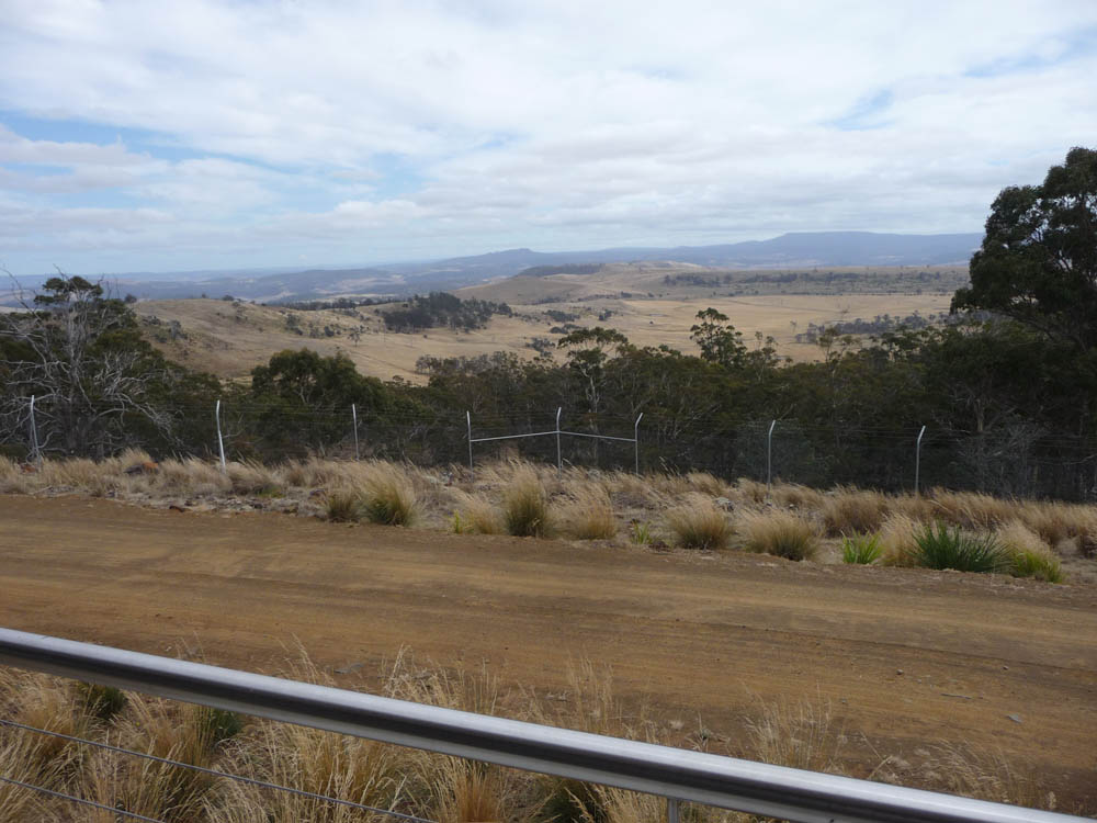
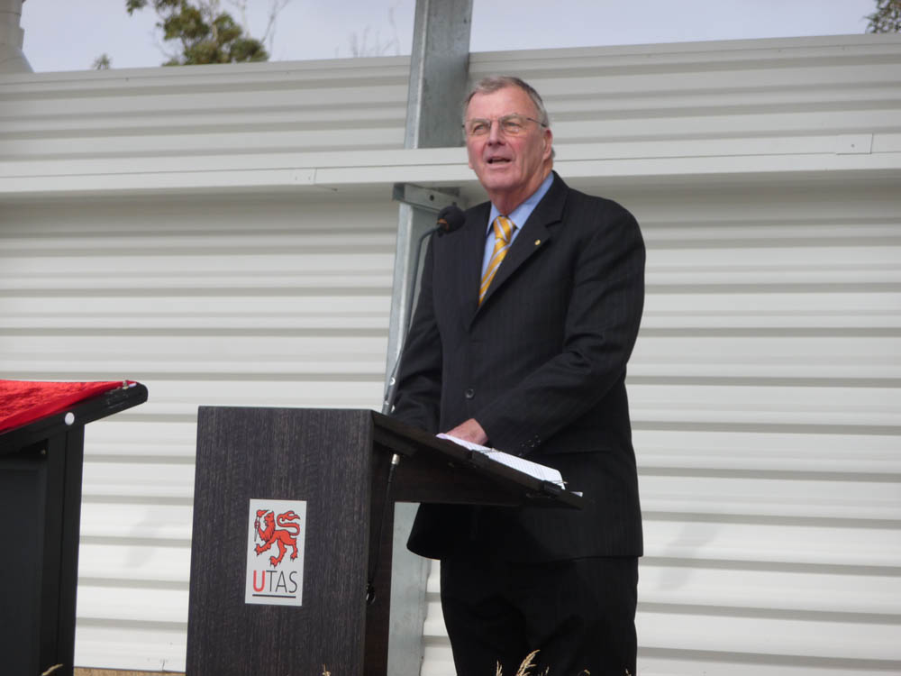
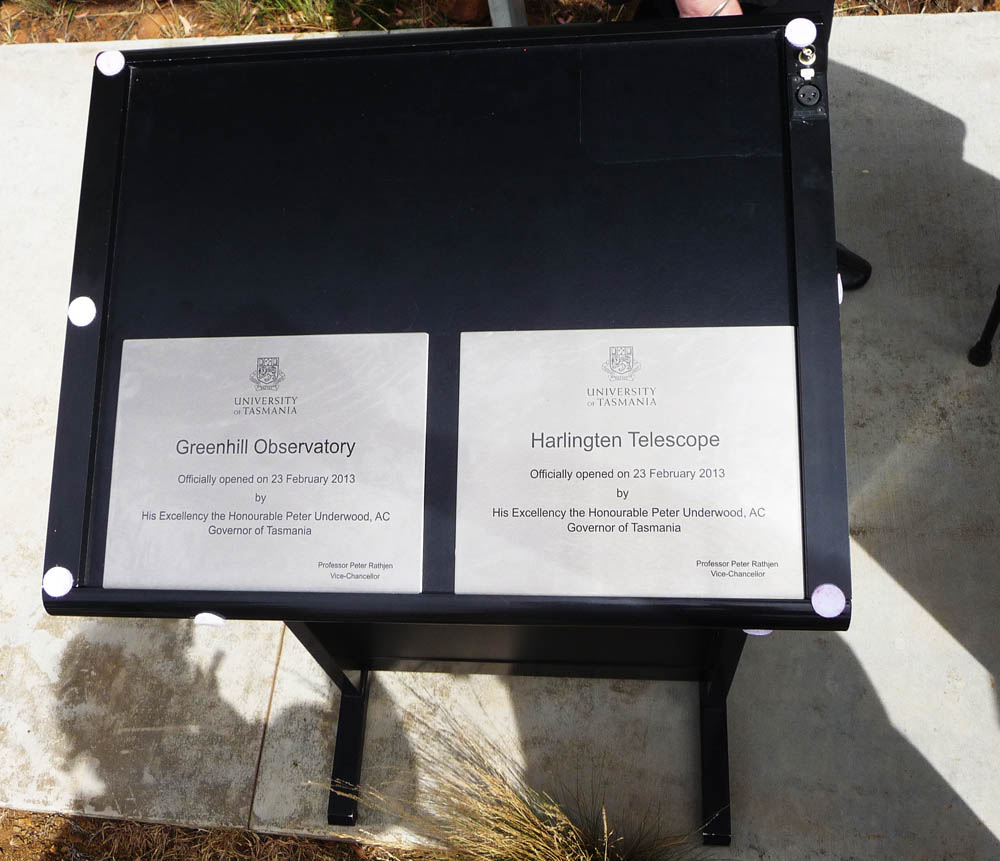
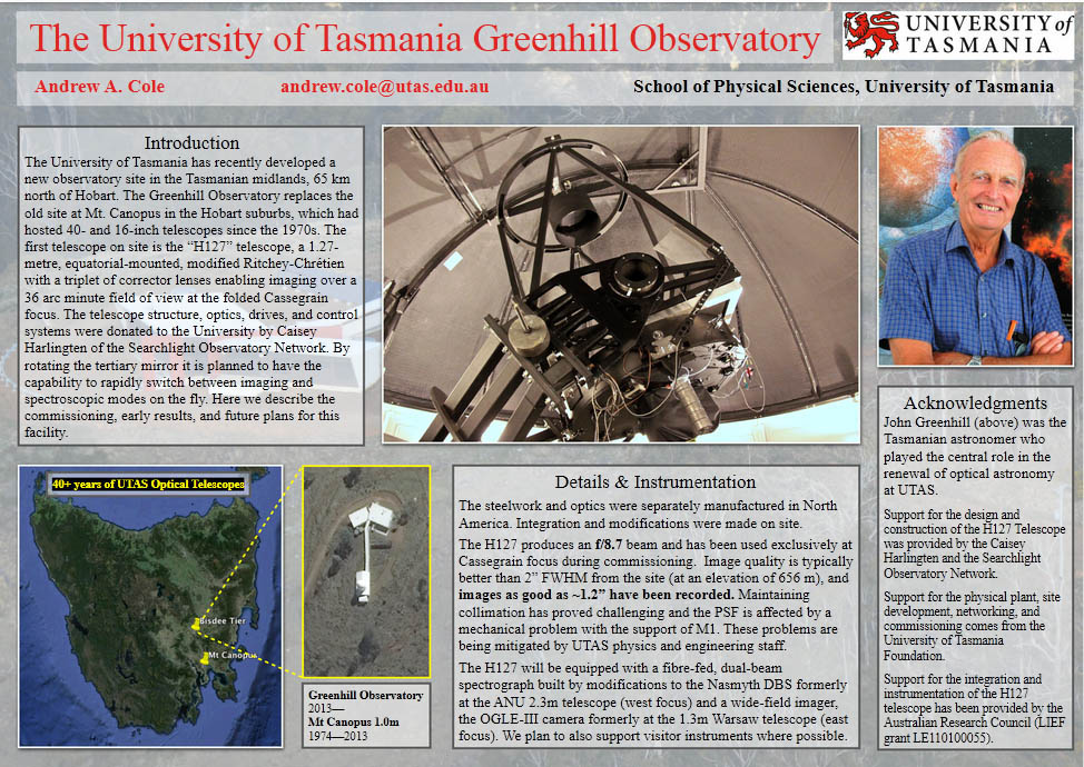
The next day we travelled back to Hobart for the Observatory
opening the following morning. Early drizzle soon stopped and the day
brightened up although a brisk wind kept it cool at the 2000 foot
elevation of the Observatory at Bisdee Tier, approximately 40 miles
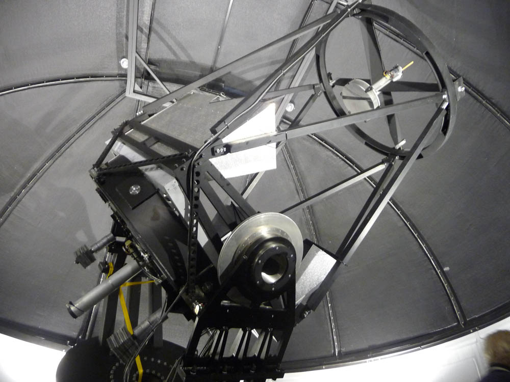
North of Hobart. The Observatory has been designed with future
instrumentation in mind, not just photography but a dedicated
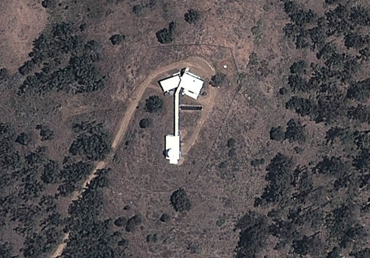
spectroscopy department. The layout is such that the residential
building is remote from the dome linked by a long corridor,
presumably to minimise thermal effects. It is clearly visible on
Google Earth! The dome itself is temperature controlled. A
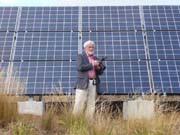
substantial solar panel array provides water heating and electricity
- I don't know whether this is the sole source charging a battery
bank or just 'green' energy in conjunction with a mains supply. The
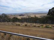
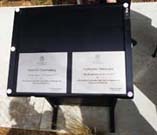
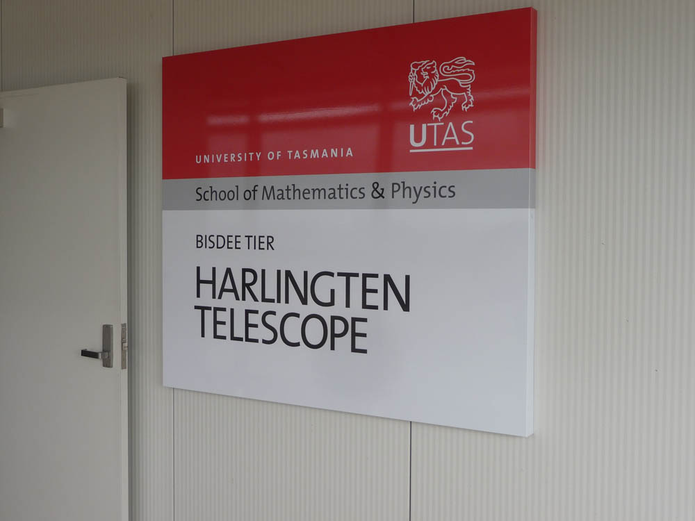
elevated location provides wonderful views on all sides. As explained
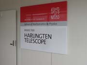
in the University description
the telescope was donated by the entrepreneur philanthropist Caisey
Harlingten. At the time of the opening it was still being
commissioned. Balanced and some drive testing and preliminary
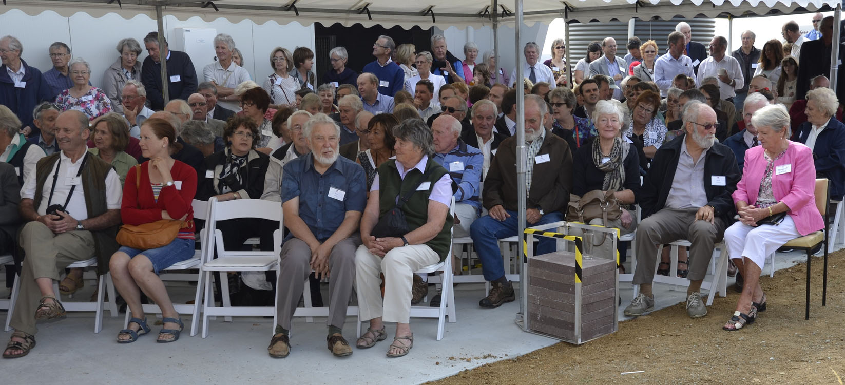
alignment, but not yet 'first light'. We met up again with noted
astronomer Shevill
Mathers who was also taking numerous photographs of the assembly,
including one with us in the pic (left front). The Tasmania Governor,
Peter Underwood (who sadly died
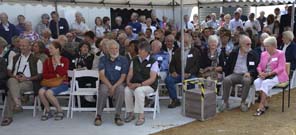
unexpectedly the following year) officially opened the facility -
quite an occasion. And again just to prove I was there!

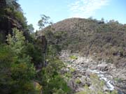
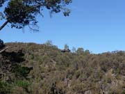
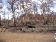
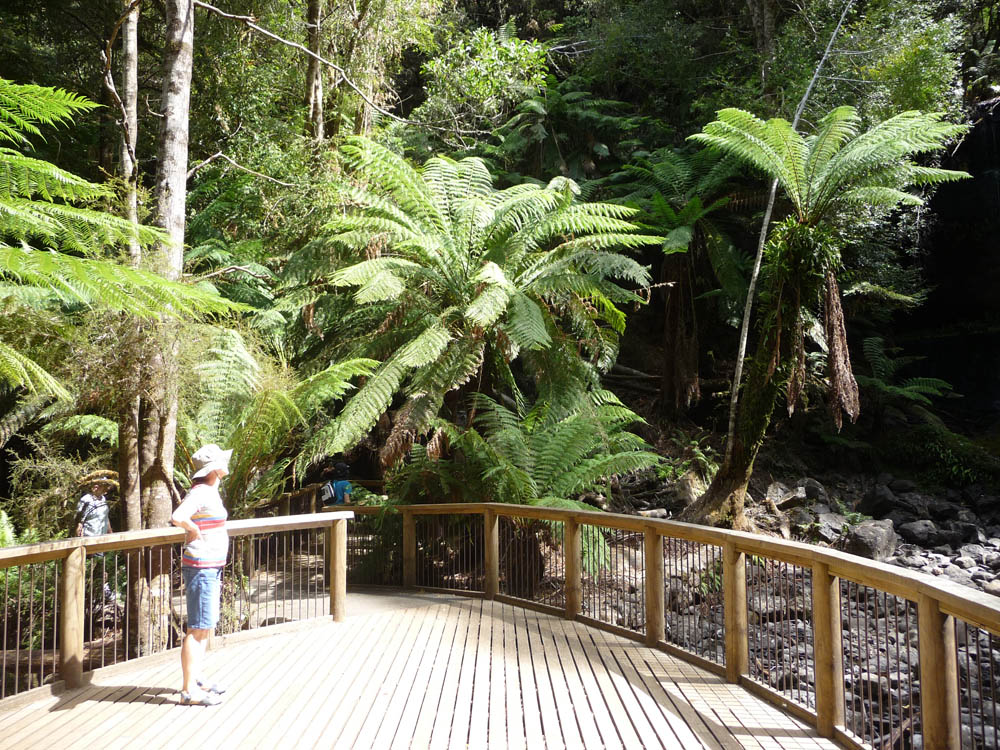
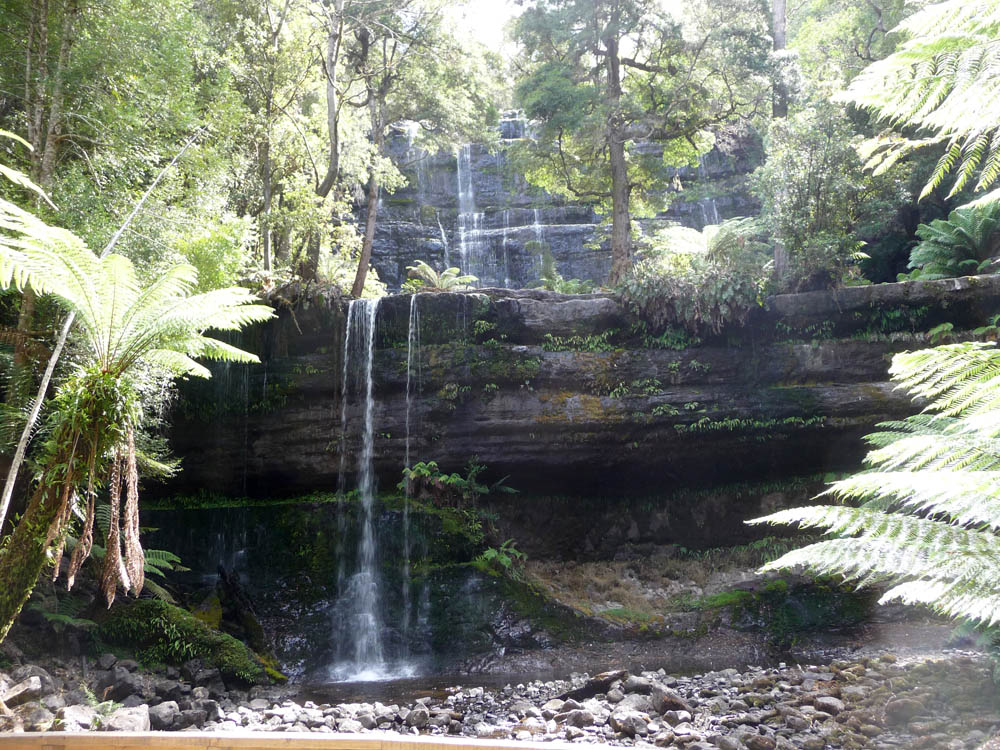
The ceremony was all over by 12 noon, so with the afternoon free
we headed West to Mount
Field National Park. On the way we passed through an area where
there had been brush fires in January. This was just one of several
devastated areas. To a certain extent fire is a necessary aid to gum
tree forest regeneration, but no one wants it in their back yard! The
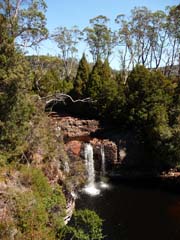
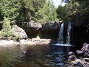
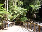
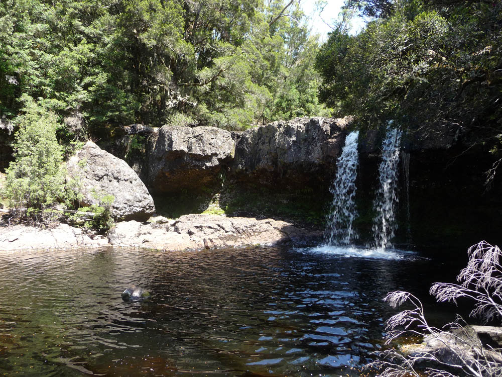
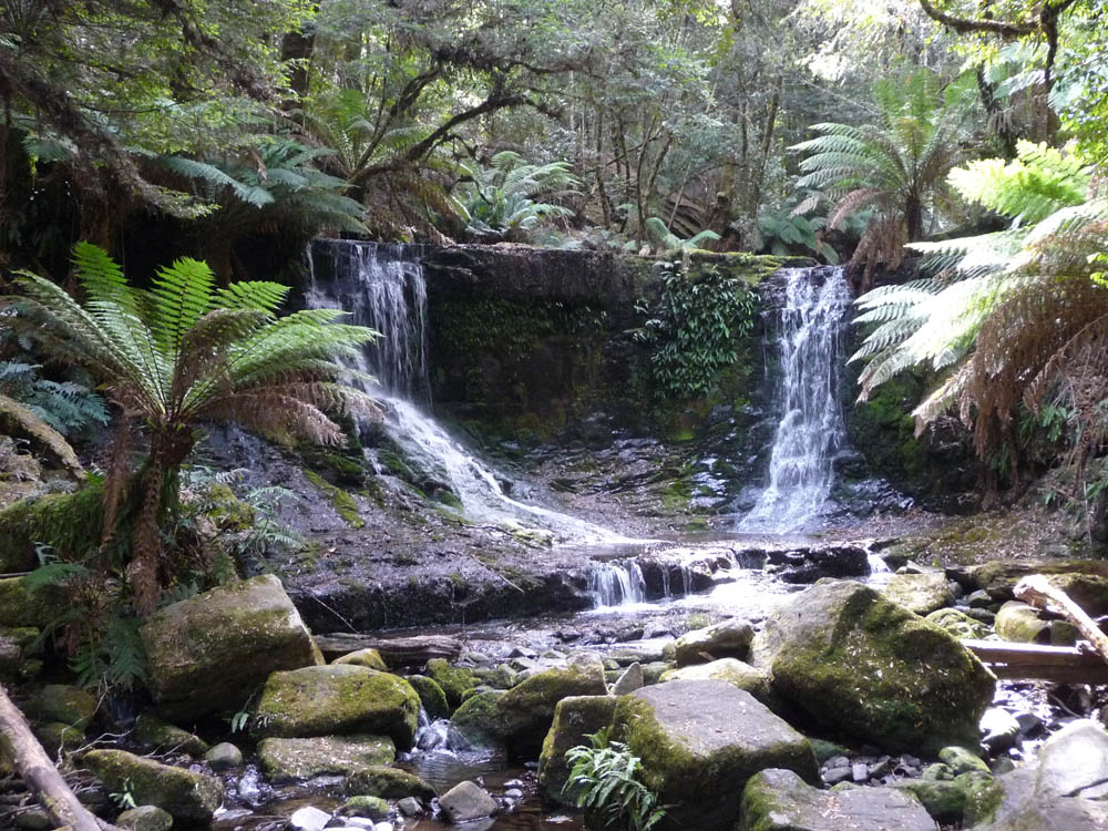
National Park was fortunately untouched. In the lower areas tree
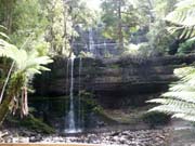
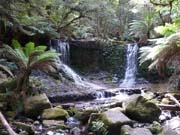
ferns were particularly abundant, and Russell and Horseshoe Falls
were beautiful even though the water flow was much reduced. The
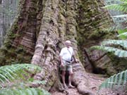
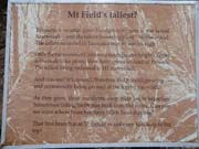
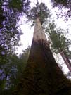
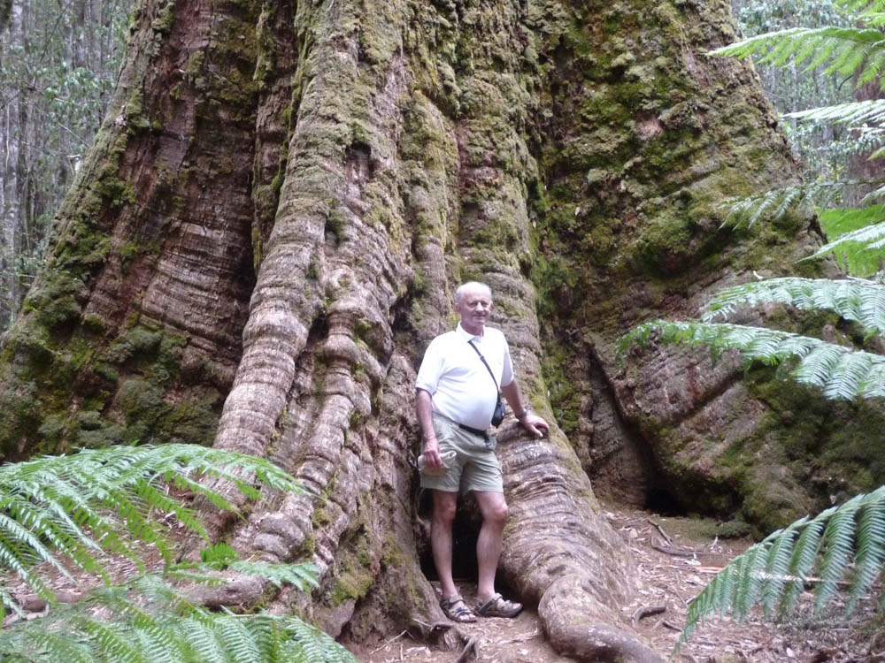
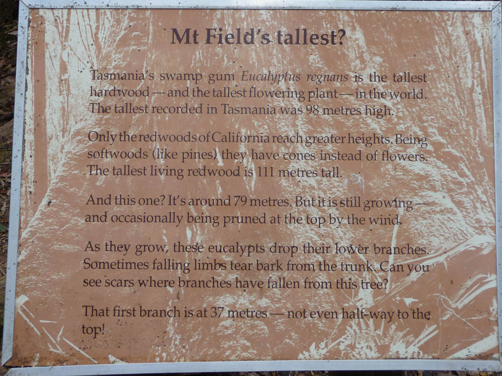
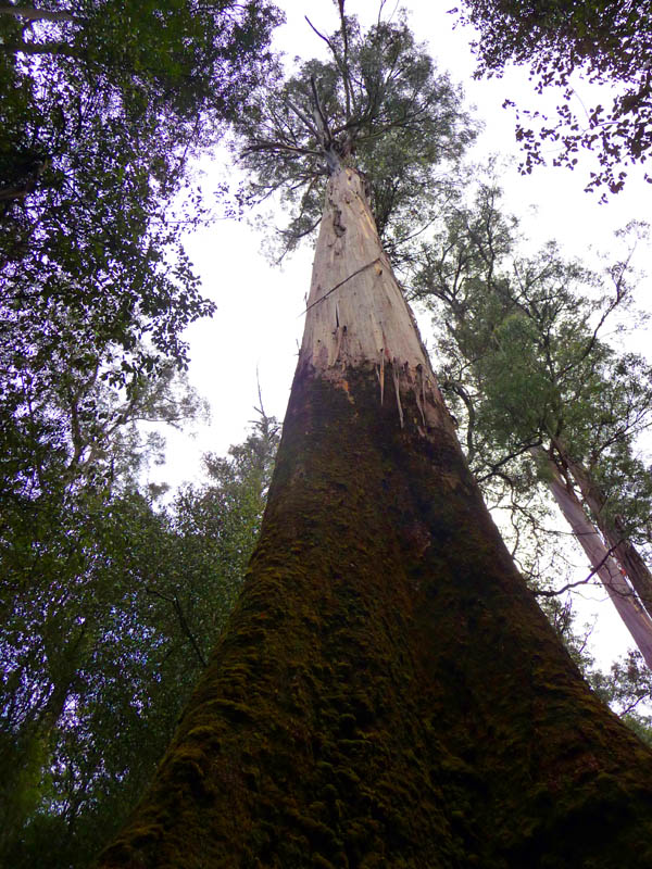
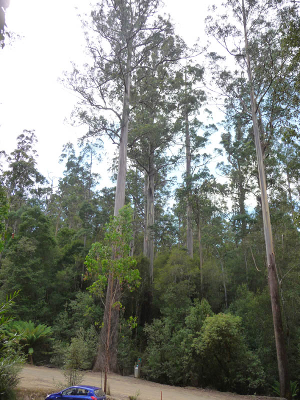
forest there boasts some of the biggest trees in Australia - the
giant swamp gum Eucalyptus
Regnans. This particular tree was the tallest in the forest at 79
metres (259 feet), and many others came close.
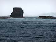
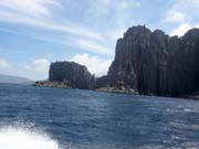
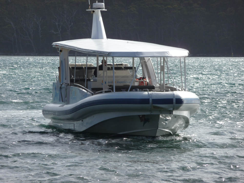
With only one more day in Tasmania before returning home, we
decided to take one of the much praised sea cruises around Tasman
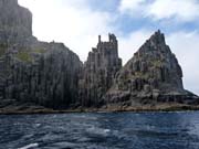
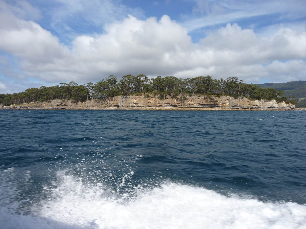
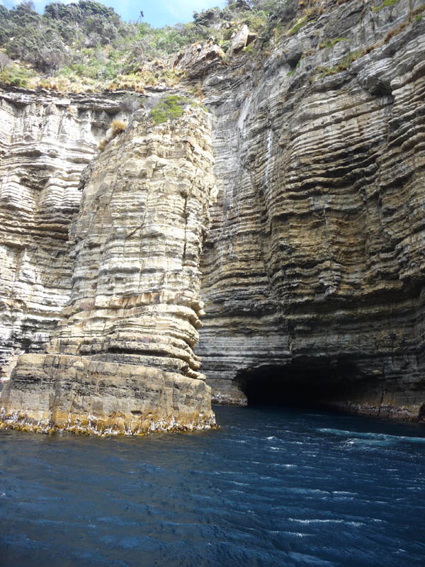
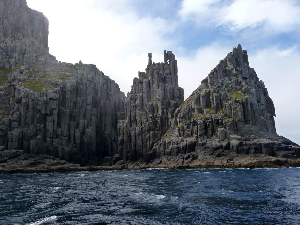
Island at the South East tip of Tasmania. Tasmania originated during
the break up of ancient Gondwanaland as a volcanic plug mainly
consisting of Dolerite,
which is particularly evident in the high cliffs of the Tasman
peninsula. During our drive down we passed huge areas of burnt out
forest and numerous destroyed houses. No photographs - it was just
too distressing. But the area near Port Arthur and the boat centre
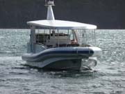
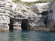
had escaped unscathed. Our boat was substantial and powerful.
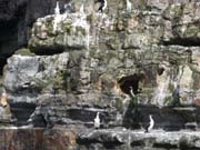
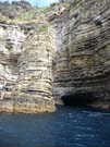
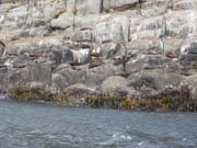
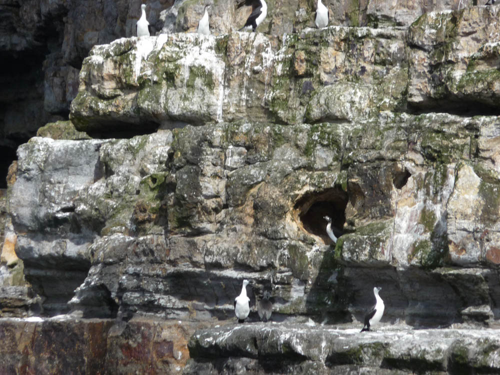
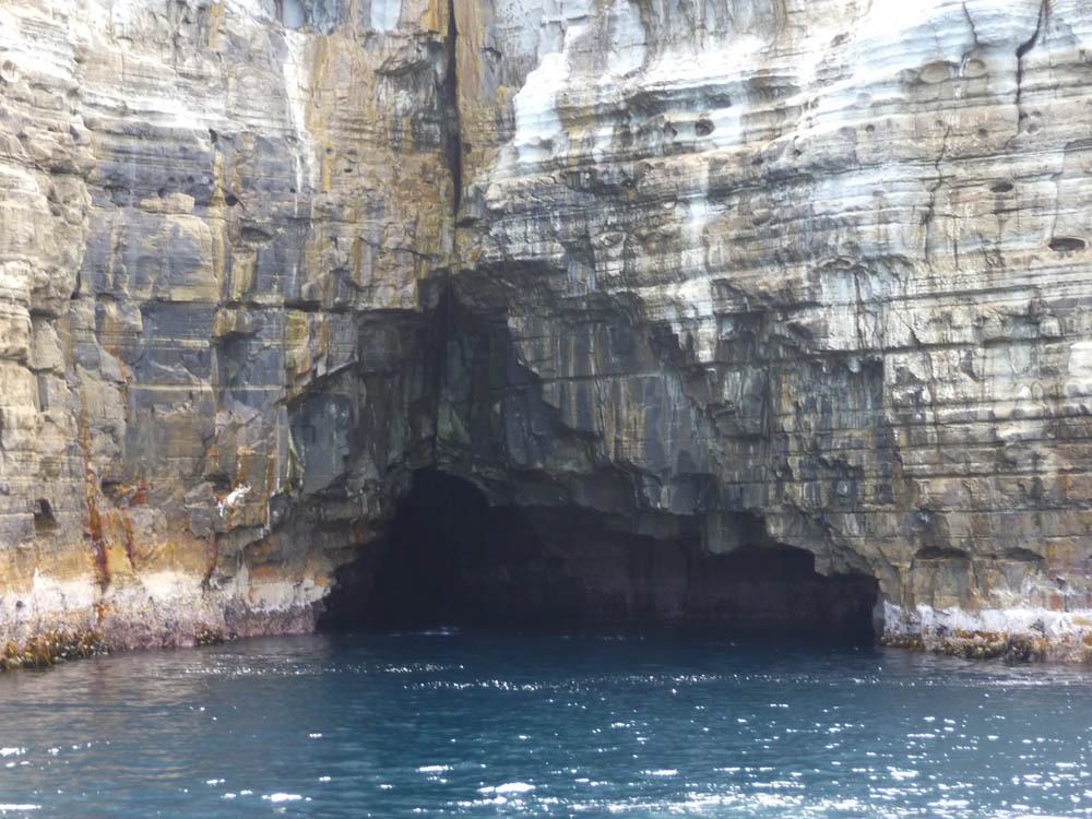
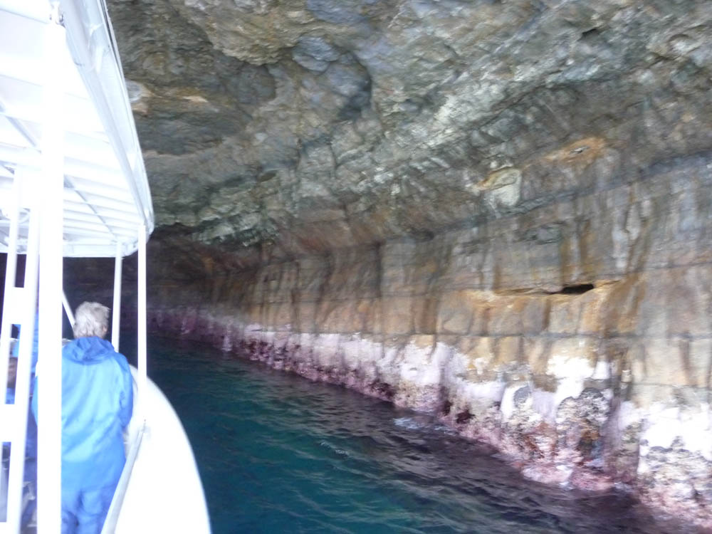
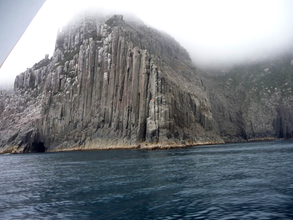
Mudstone cliffs were in evidence, particularly favoured as nesting
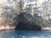
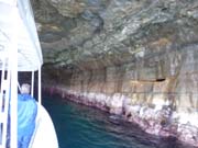
areas by seabirds. Numerous sea caves had been eroded over the
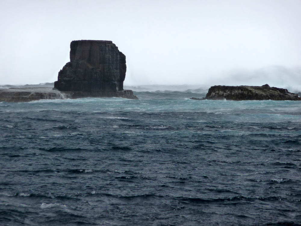
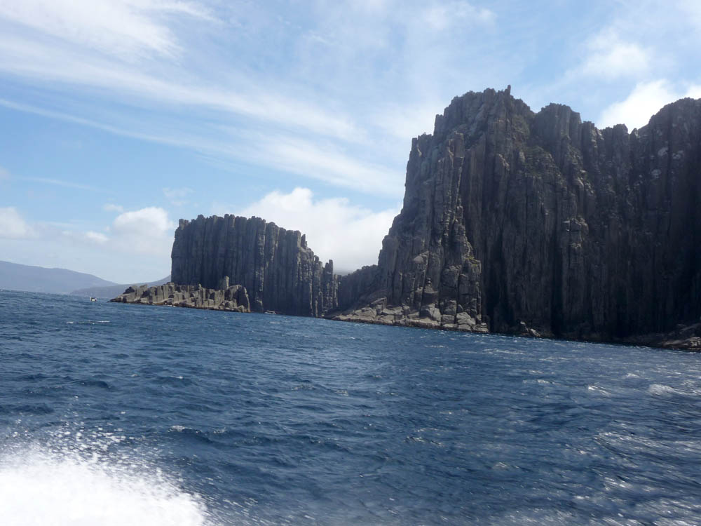
millenia and the boat entered several of these. We needed to keep in
the shelter of the land - there was a strong North Easterly blowing,
and the gap between the mainland and Tasman Island was quite wild, so
we were unable to completely circumnavigate it. But what we did see
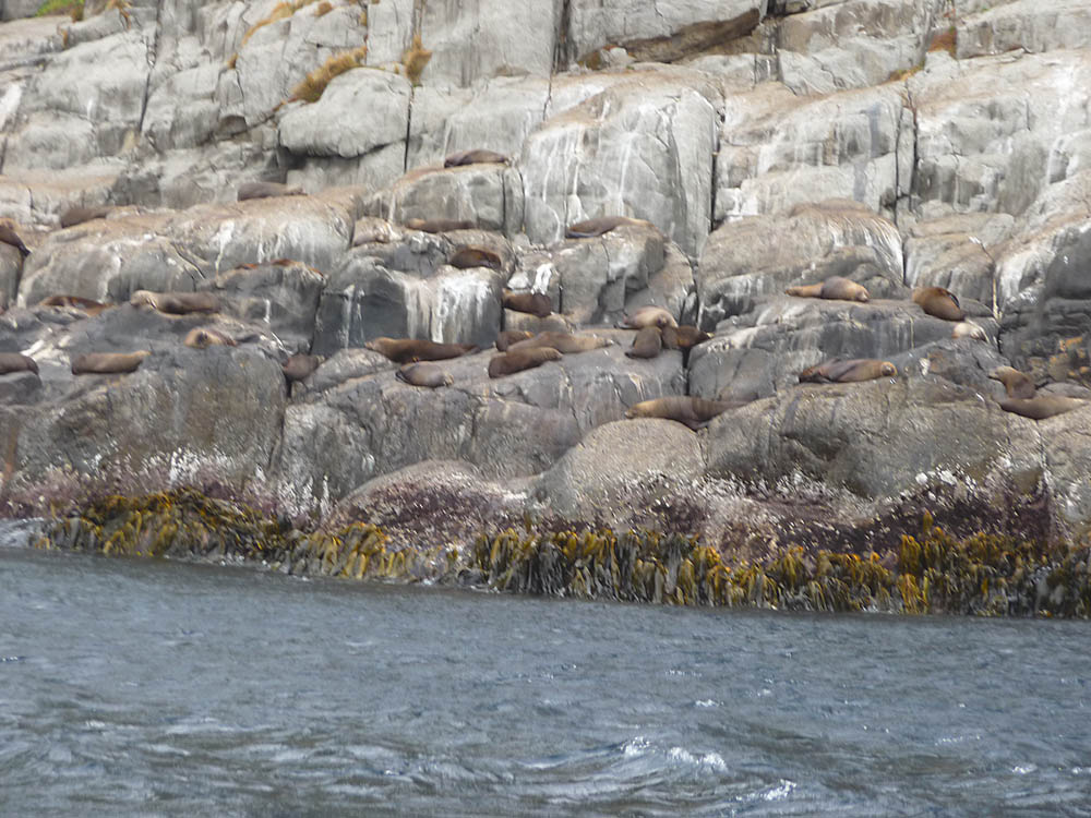
was most interesting with brown Fur Seals in abundance and the
massive striated Dolerite cliffs towering over all.


