
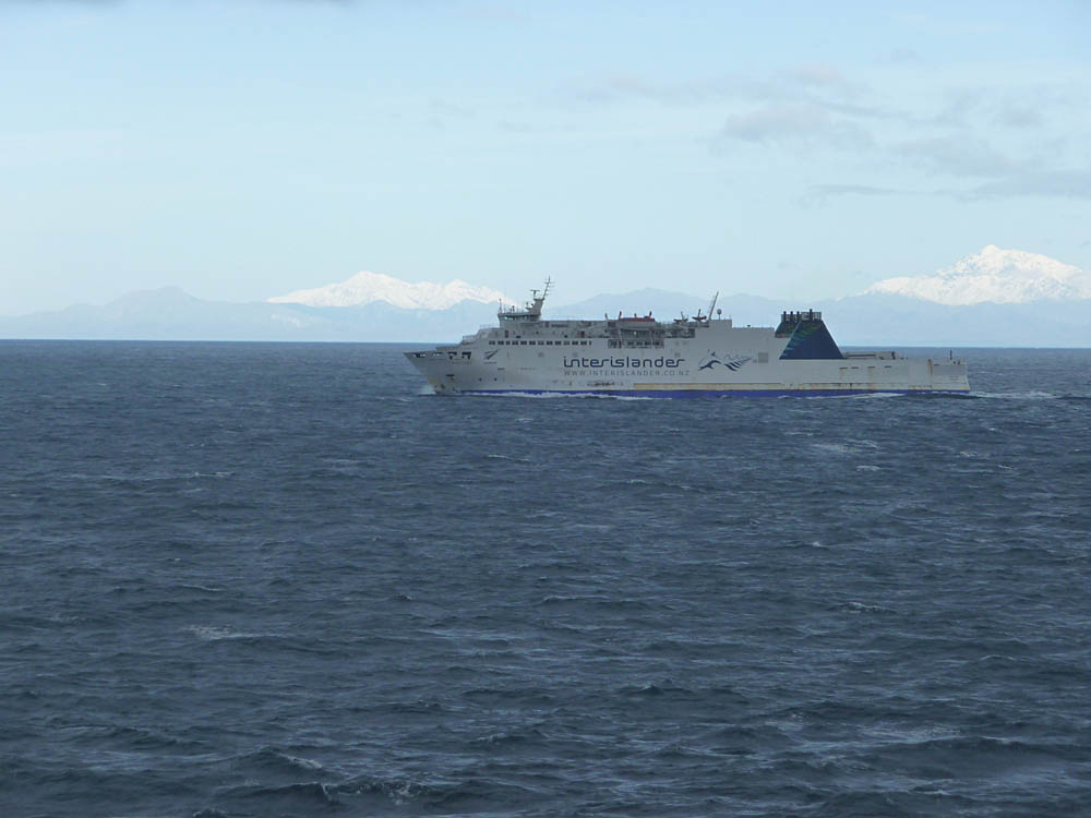


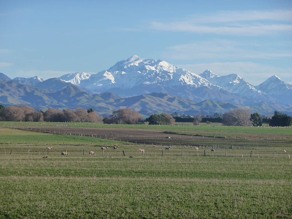
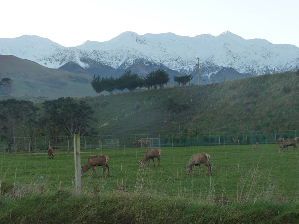
The Cook Strait is only 13 3/4 miles (22 Km) wide at its narrowest point, but because the ferry has to travel around headlands and up the fjords of Tory Channel and Queen Charlotte Sound, the journey takes a little over three hours. But it's an impressive three hours! Our first glimpse of the South Island snow covered mountains was looking down the East coast to the Kaikoura range. Then a wonderful journey through the fjords before arriving at Picton. Although the weather closed in for a while, once we were ashore things improved and our drive down to Kaikoura itself was beautifully clear with the highest of the Kaikoura mountains, Mount Manakau (8560 ft., 2609 m.) dominating the scene. Some sheep farmers have gone over to deer farming, an interesting sight set off again by the Kaikoura Range of mountains.
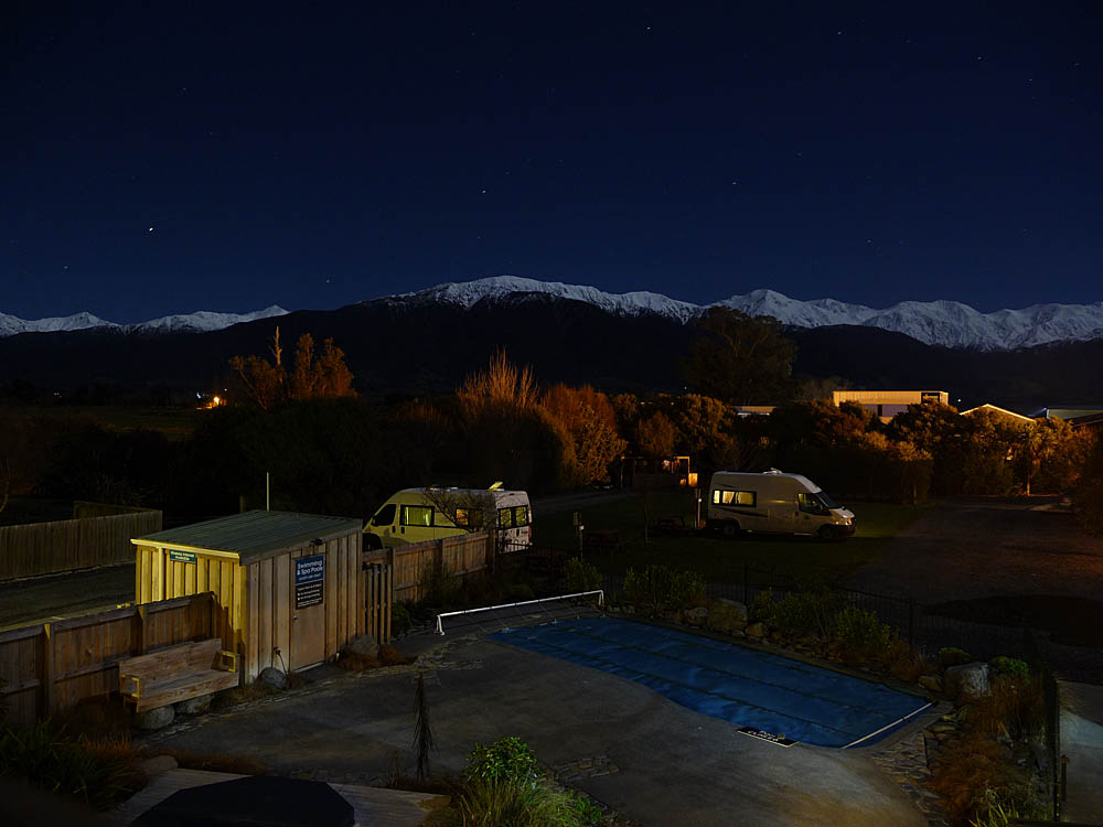
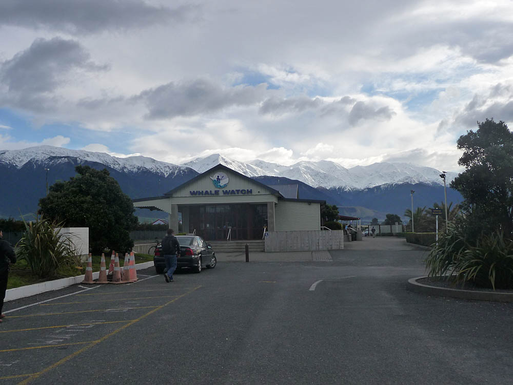
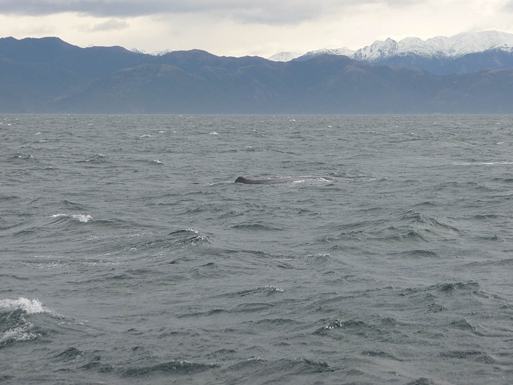
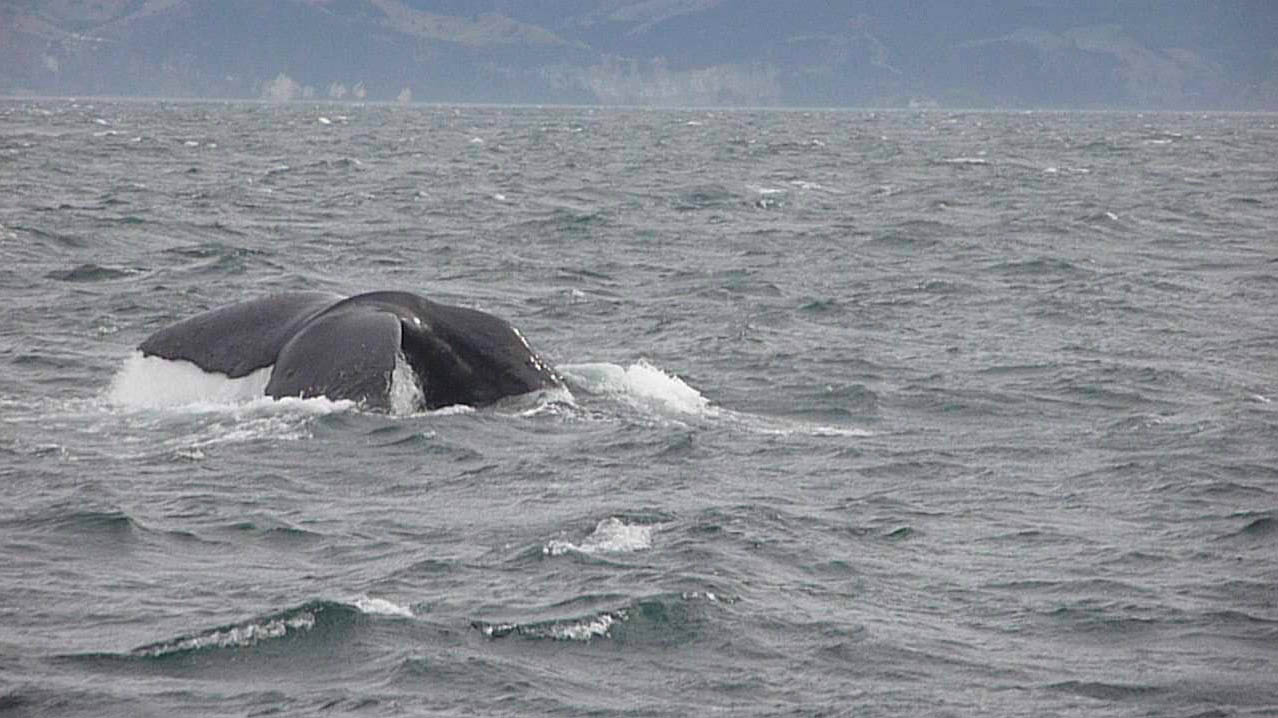
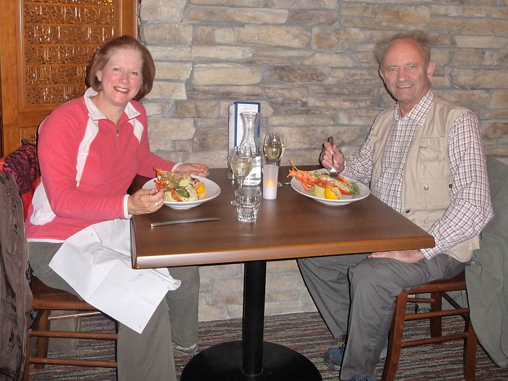
Our main reason for visiting Kaikoura was the 'Whale Watch' attraction. A pod of Sperm whales lives there most of the year due to the presence of a deep trench just offshore where there is a plentiful supply of food. More details here and here. Although our first night stop was beautifully clear, unfortunately the next day the weather closed in, and we only saw one whale before being forced to cut the trip short. So only a couple of photos, the sounding whale being a still from a video taken with my TZ5 camera. That evening we consoled ourselves by sampling the local crayfish delicacy. Typically the next morning dawned cold and clear. But we had to move on.
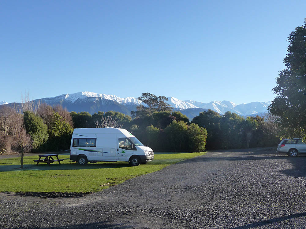
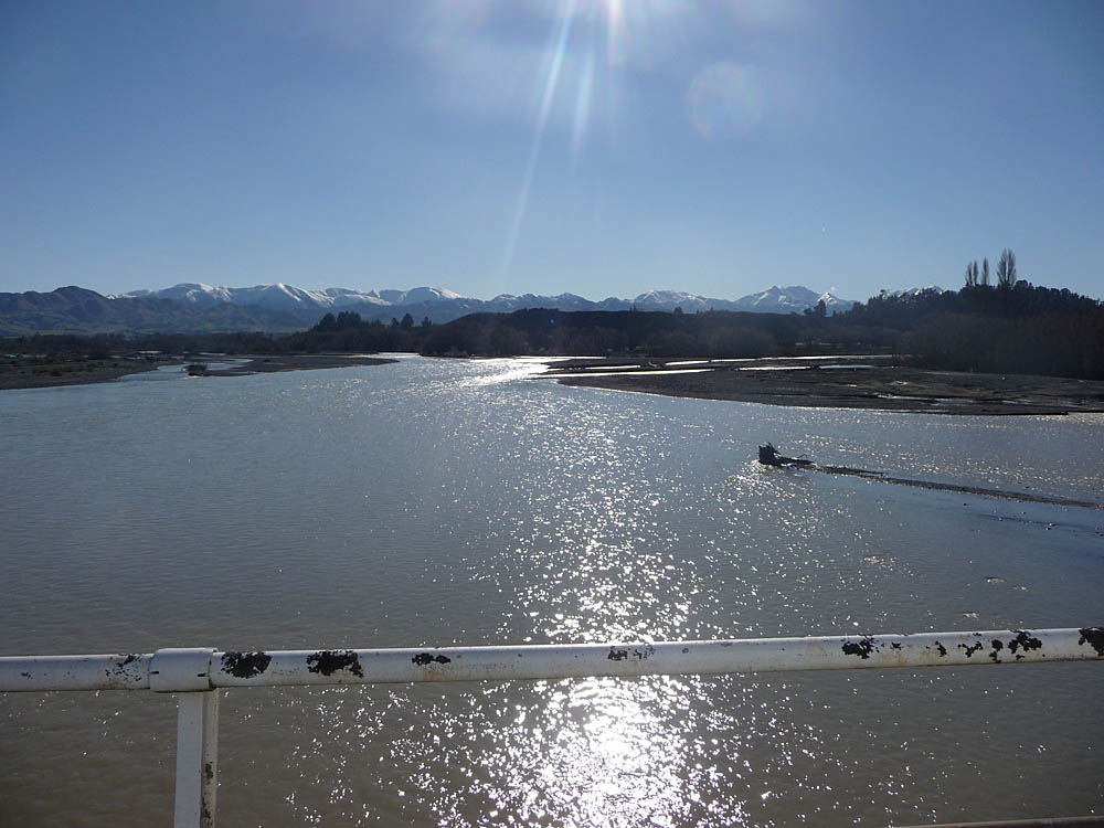
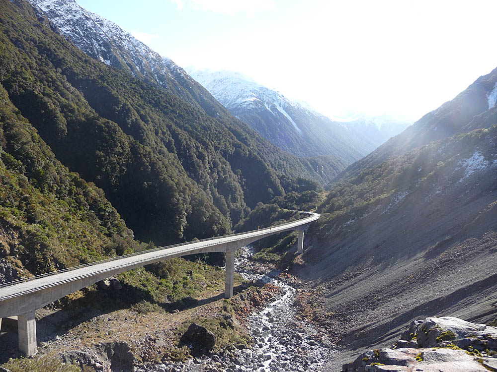
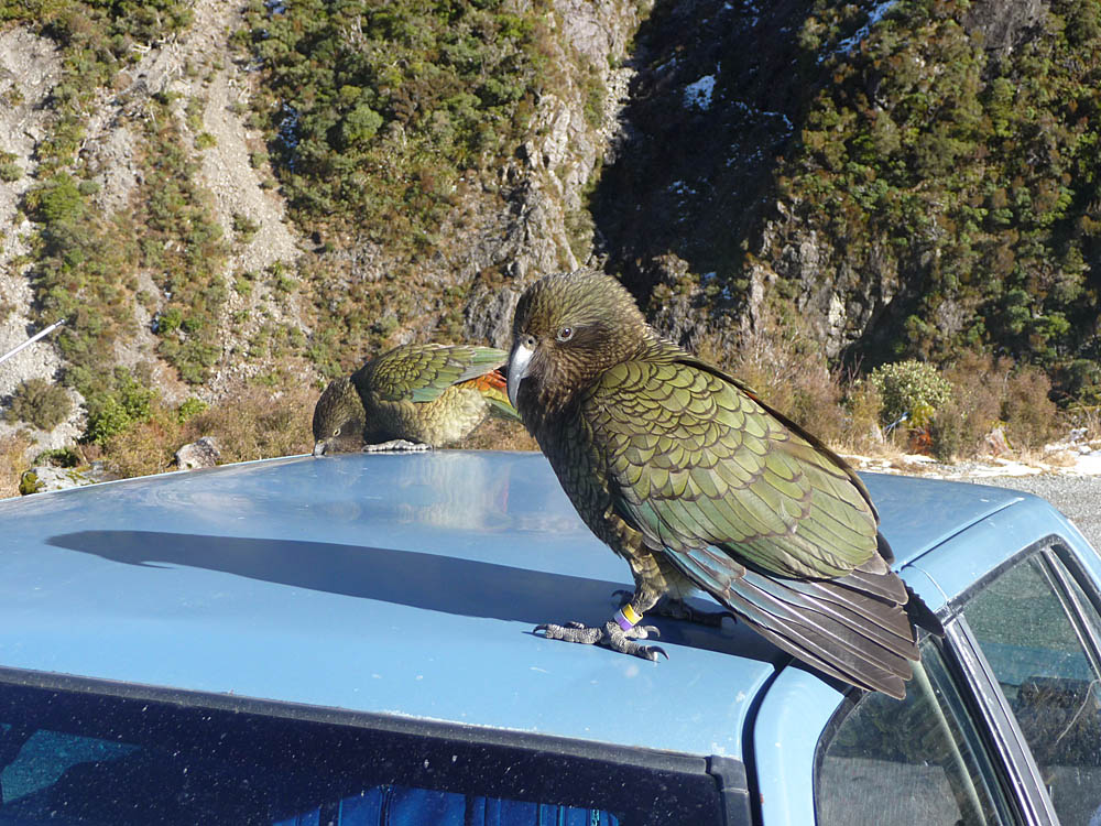
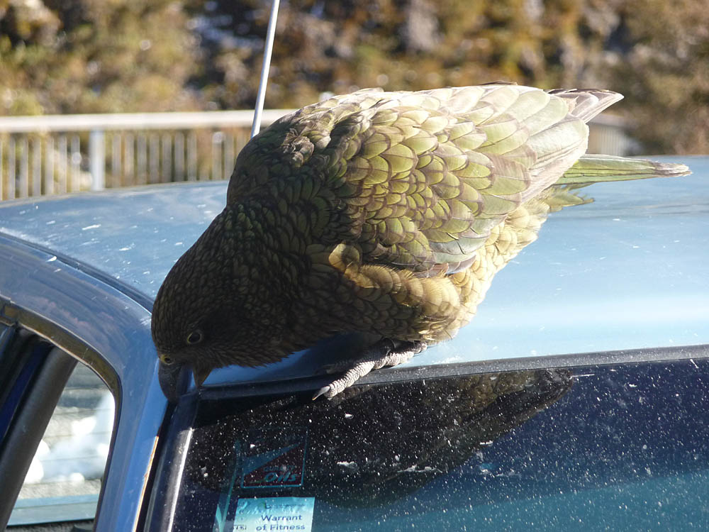
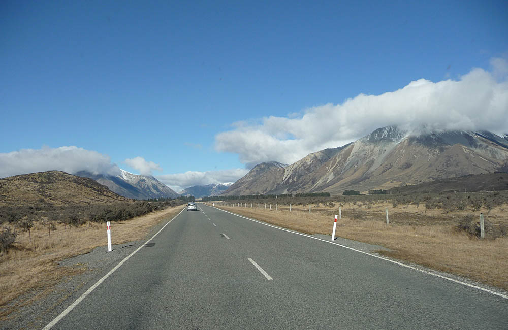
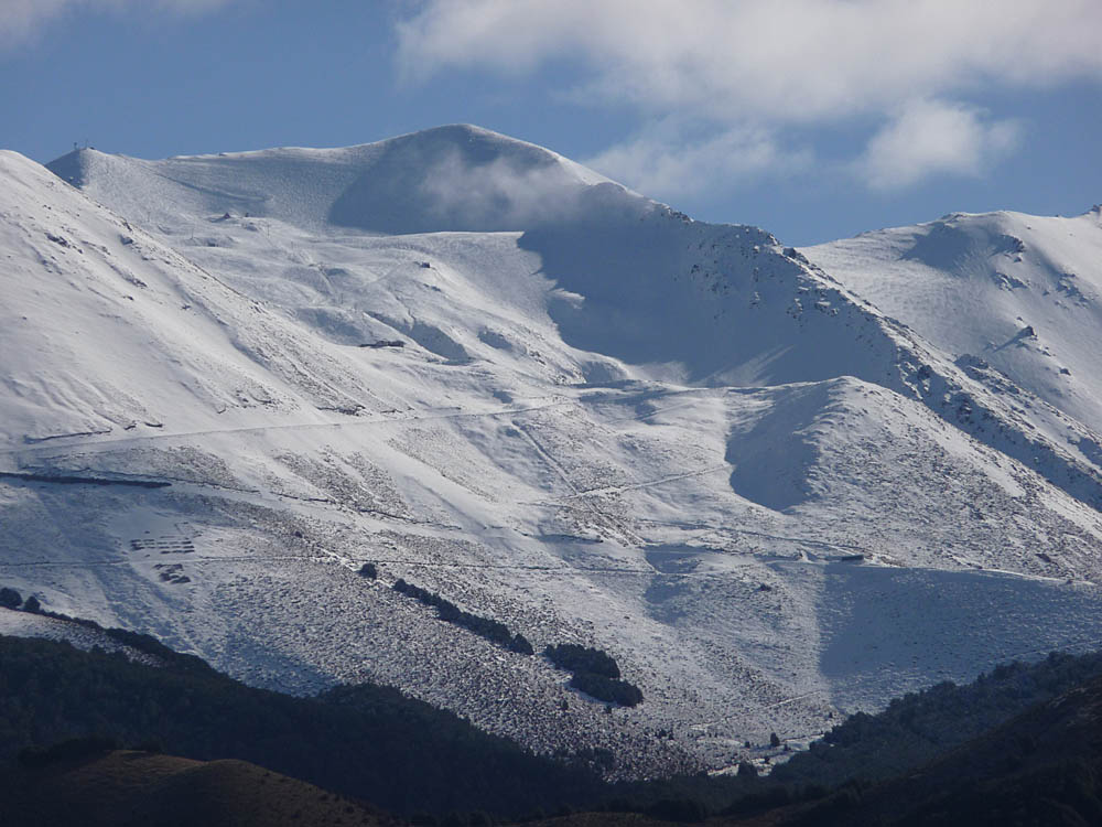
Moving on in South Island was even more of a delight than North Island. With only around 1 million population, and 1/3rd of that concentrated in and around Christchurch, the place feels empty! We could drive for miles on well surfaced roads with almost no other traffic. Rivers obviously flooded in the Spring, and we were always aware of snow capped mountains in the distance. Being winter time we avoided snow covered roads in the motor caravan, (although we were carrying snow chains, they were just for emergency use), but were able to cross over to Greymouth on the West coast and back again. The return road over Arthur's Pass and the magnificent Otira viaduct had a viewpoint near the top, just on the snow line, and was frequented by a number of beautiful and extremely cheeky protected Kea parrots who had taken a particular shine to a blue car and seemed determined to dismantle it! When the car left they then turned their attention to the van. Time to go!
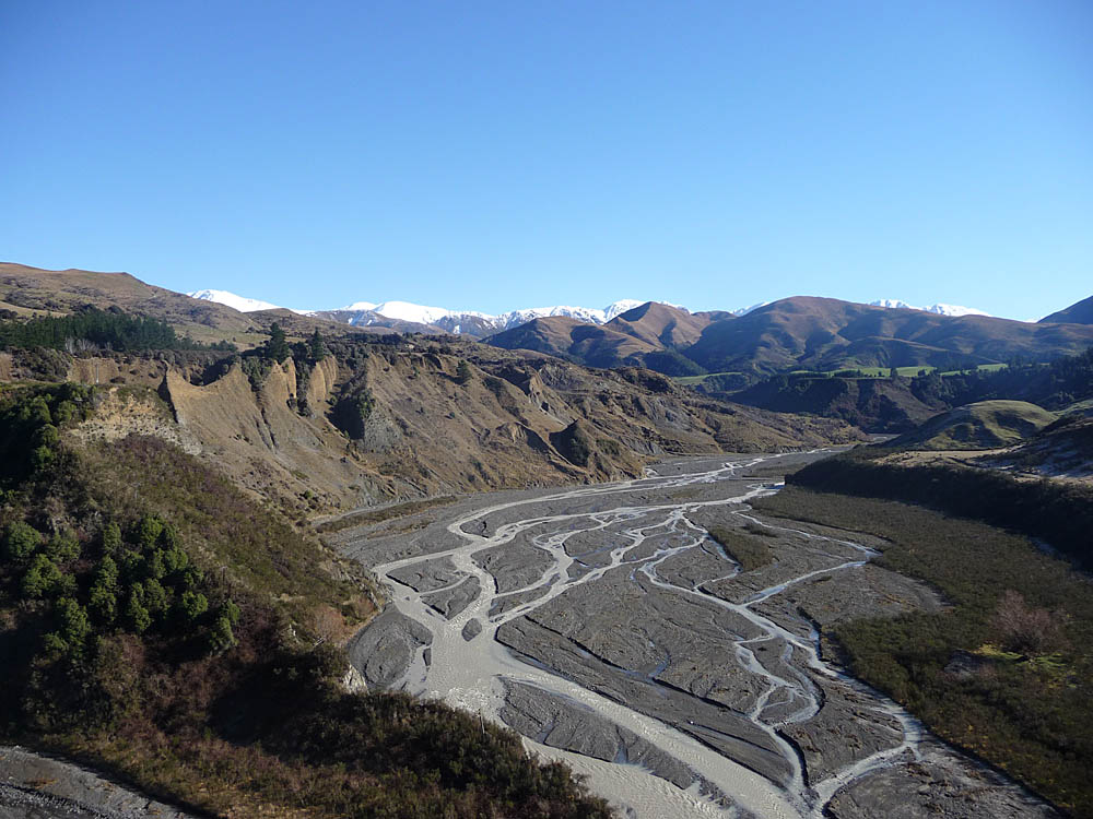


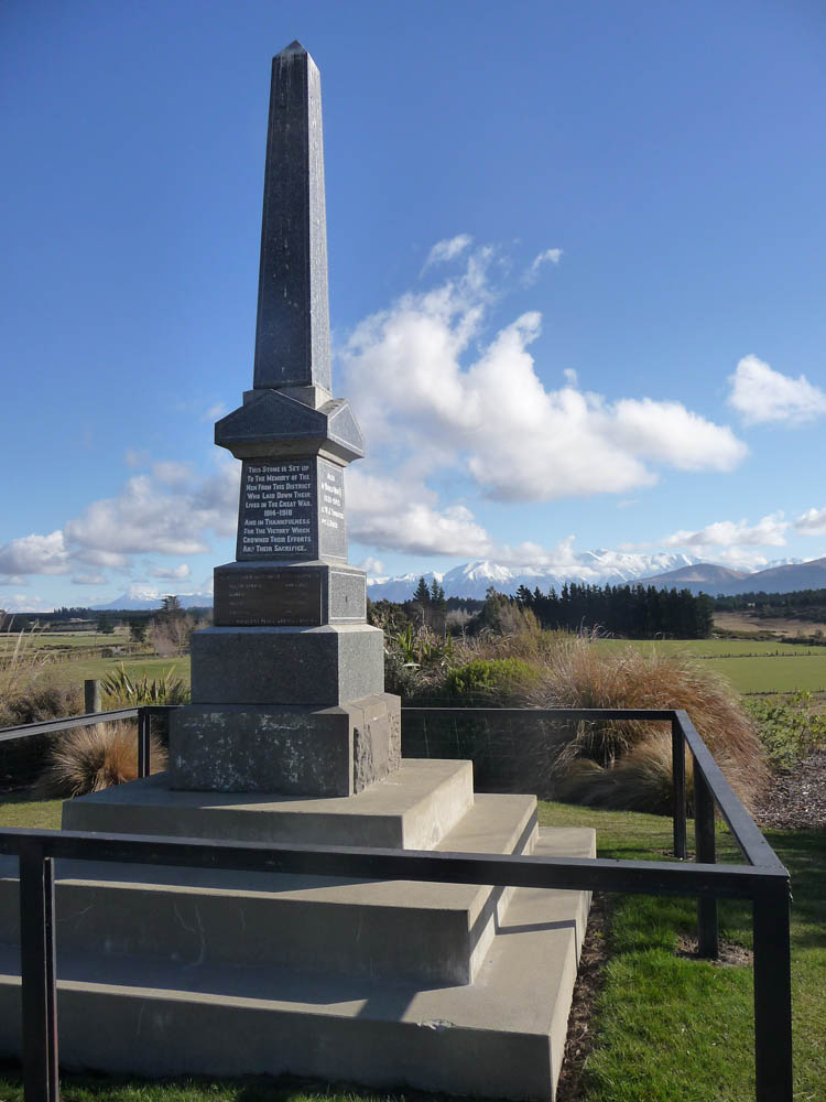
Our travels the rest of that day took us through endless vistas of open country. A beautiful location for a war memorial. Ski slopes en route.
![]()
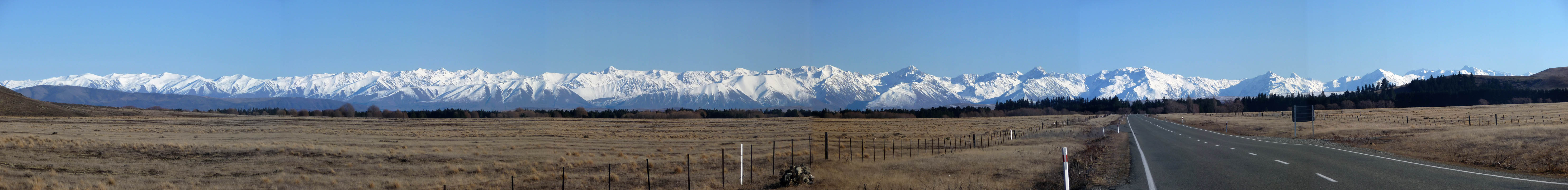
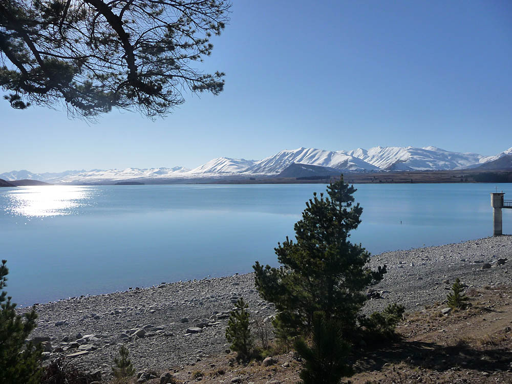
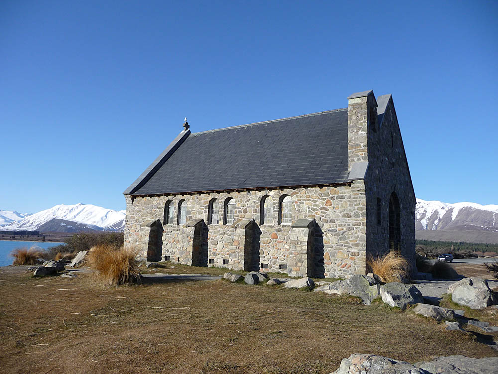
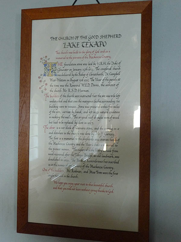
The following two nights we stayed at the small town of Fairlie, about half way down the South Island and as far South as we were able to go in the time available. But it was only 27 miles from Lake Tekapo on the Eastern fringe of the Southern Alps. The drive from Fairlie into the Alps gave superb views of the mountain range. Lake Tekapo is a popular holiday destination and deservedly so - it was stunningly beautiful! I doubt any church has better views behind the altar!

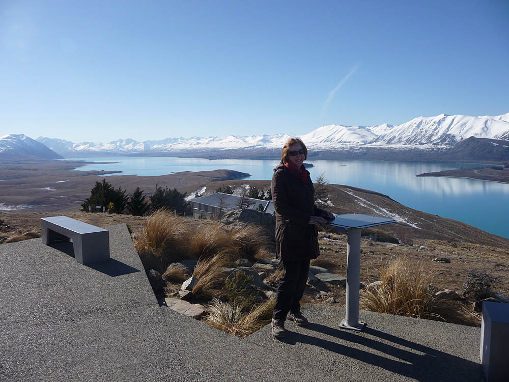
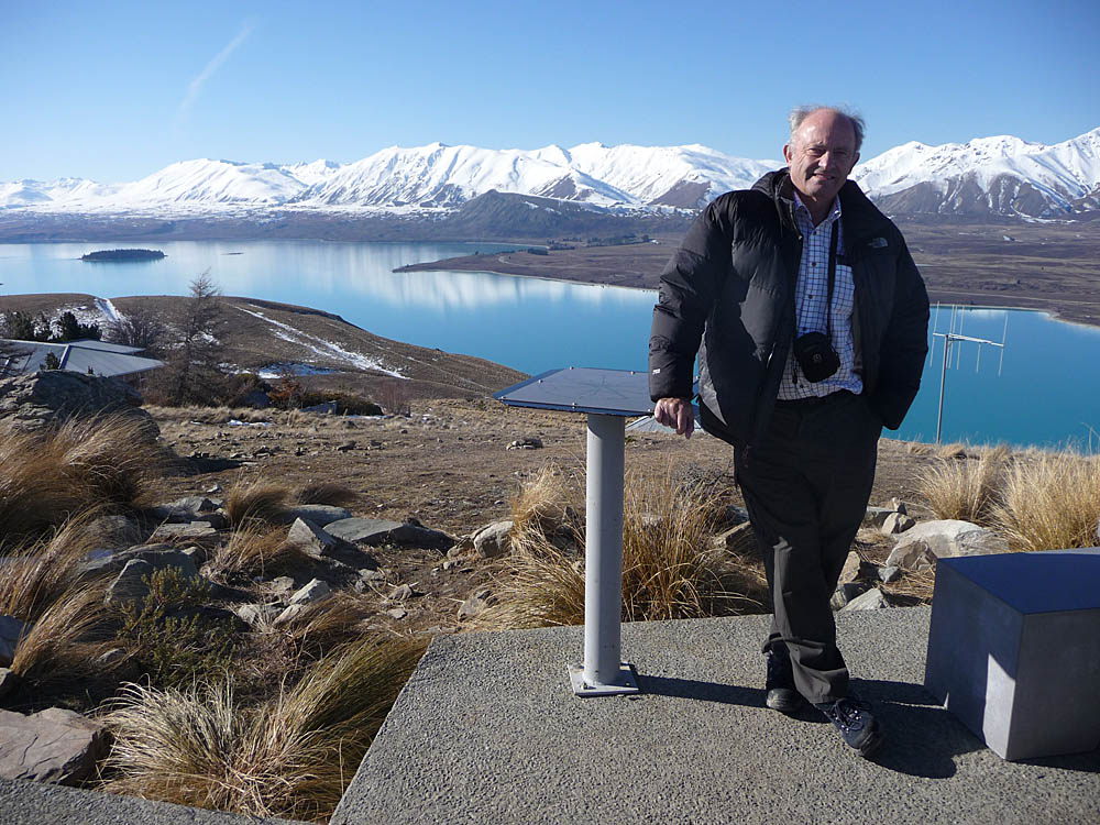
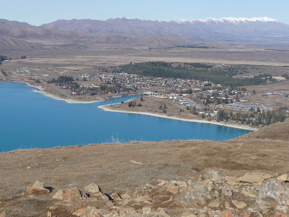
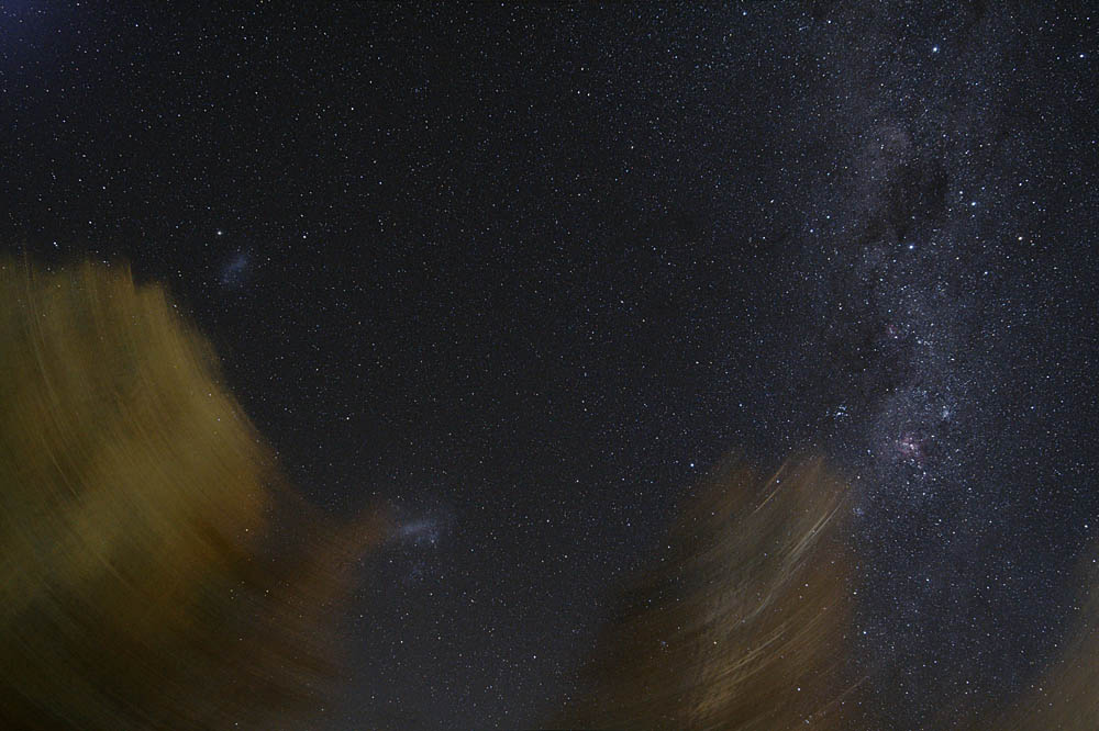
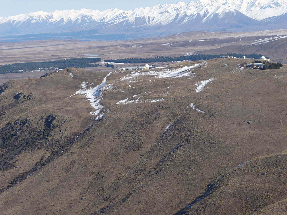
We drove up the winding road to Mount John Observatory visitor centre just outside the town where we were rewarded with amazing views along the lake and over the town. No visiting to the telescopes unfortunately! But the skies in that area can be incredibly clear and at night the Milky Way splashed brightly across the sky. That night, although the Moon was rising early, from the Fairlie campsite I was able to take the only photograph I managed of the Southern Milky Way and Magellanic Clouds. Unfortunately trees obscured some of the sky. But here it is, taken with my Canon 350D camera on a driven mount. More details and a larger image here.
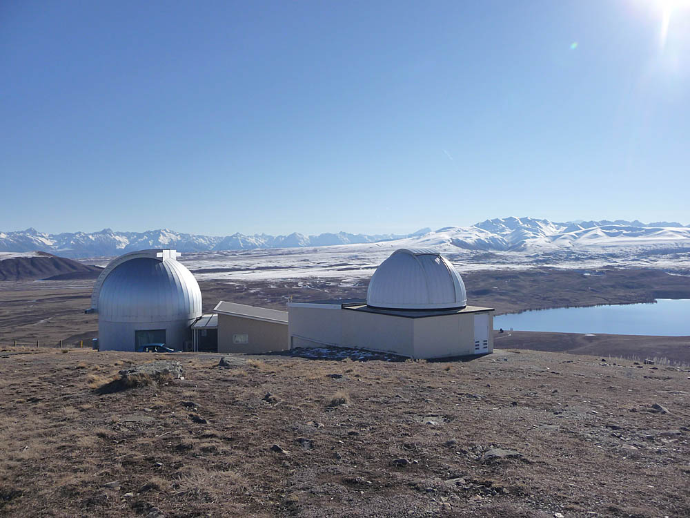
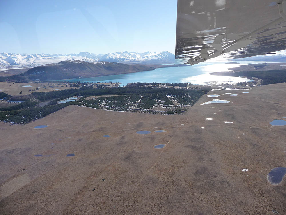
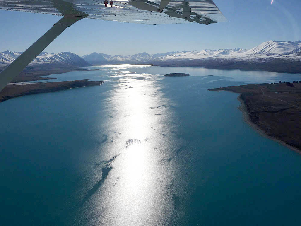
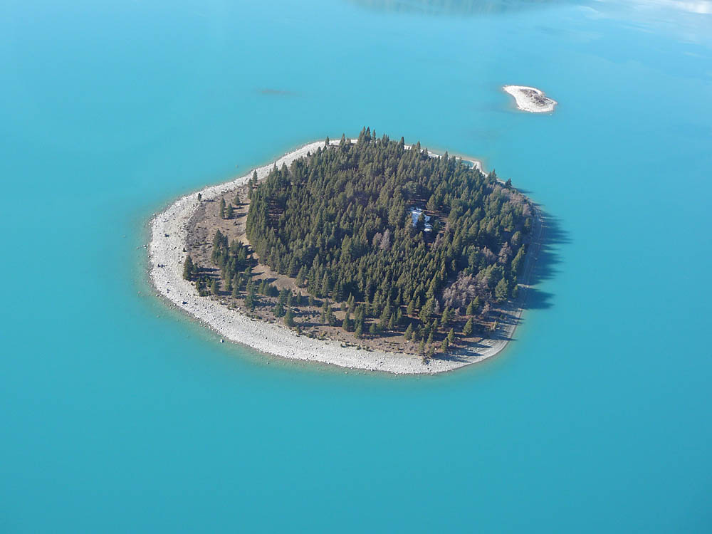
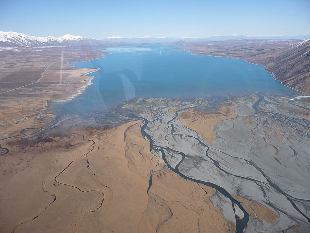
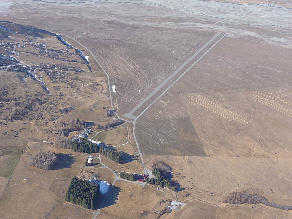
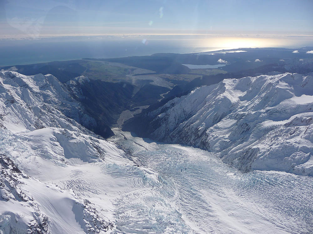
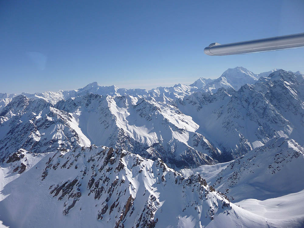
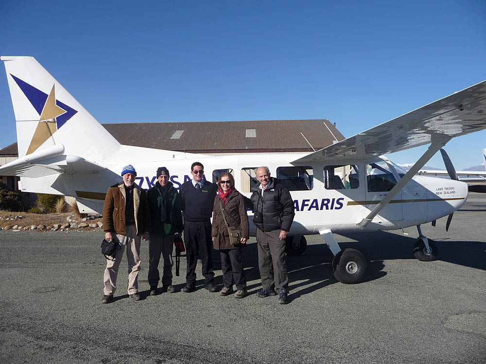
But before visiting the Observatory we experienced another truly high spot of our holiday - an Air Safaris 'Grand Traverse' flight into the Alps in a light plane. Aerial shots of the town and the Observatory. The views over Lake Tekapo were superb, showing the lovely turquoise colour. The head of the valley floods badly in the Spring when the only access to a remote farm is via its own airstrip.

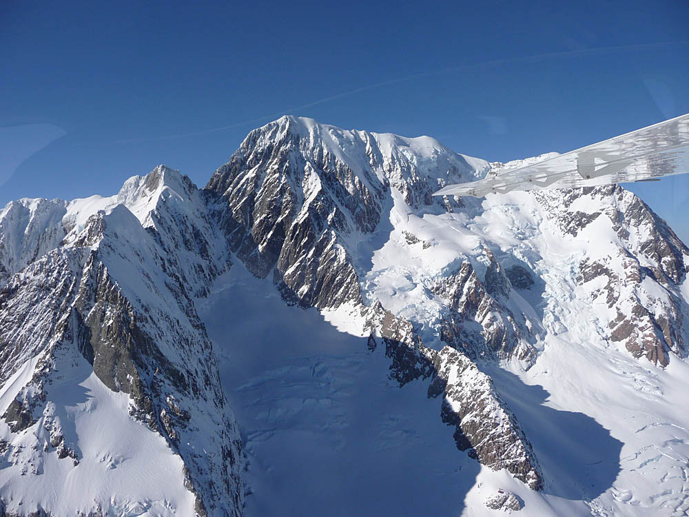
The weather conditions were superb - clear air and no wind, so the pilot was able to fly very close to the mountains. Wonderful views of the glaciers and 11,477 ft. (3,498 m.) Mount Tasman.
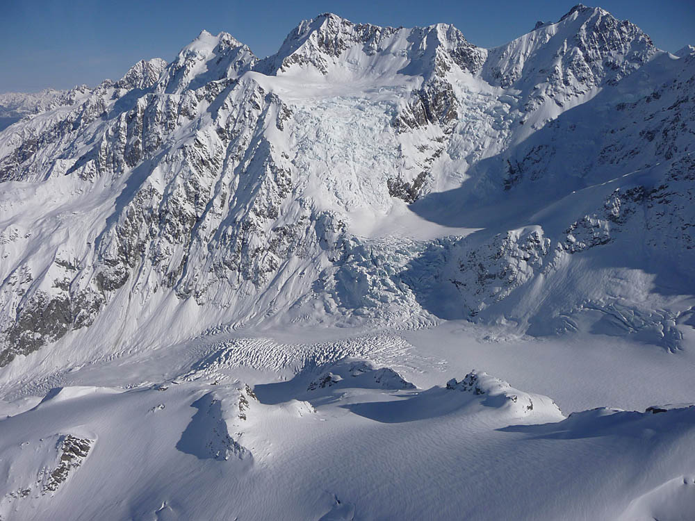
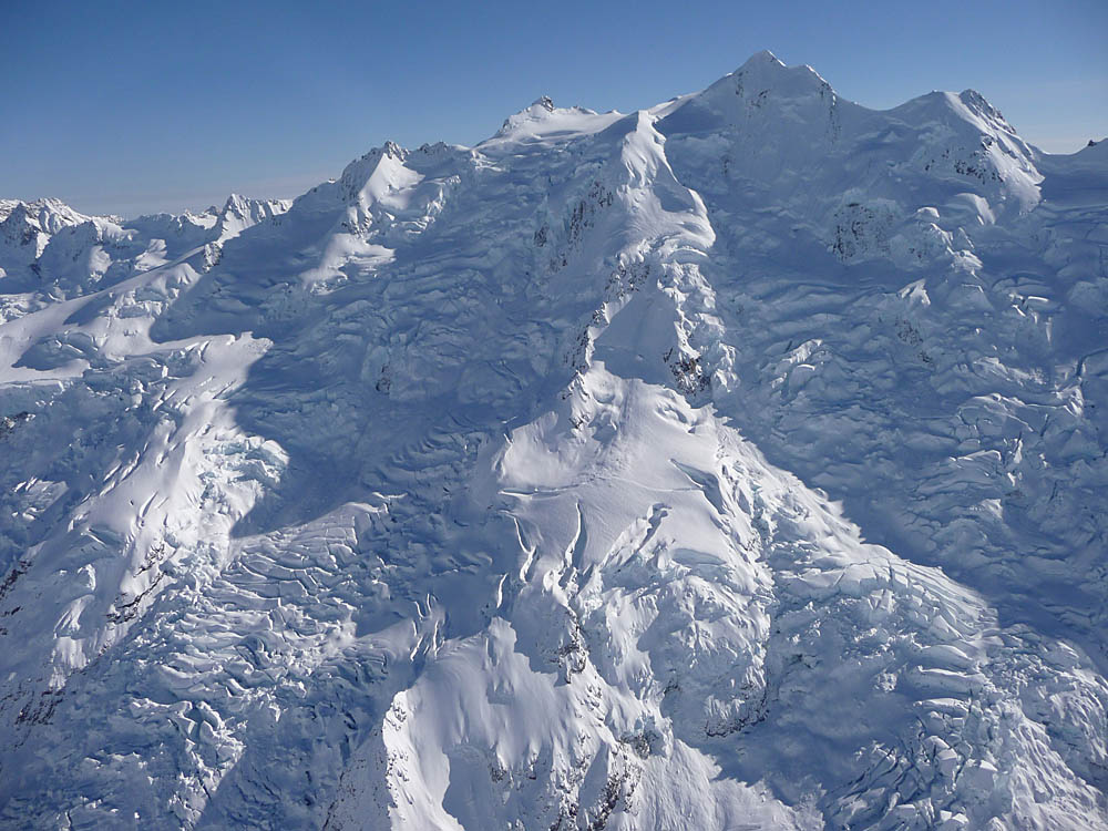
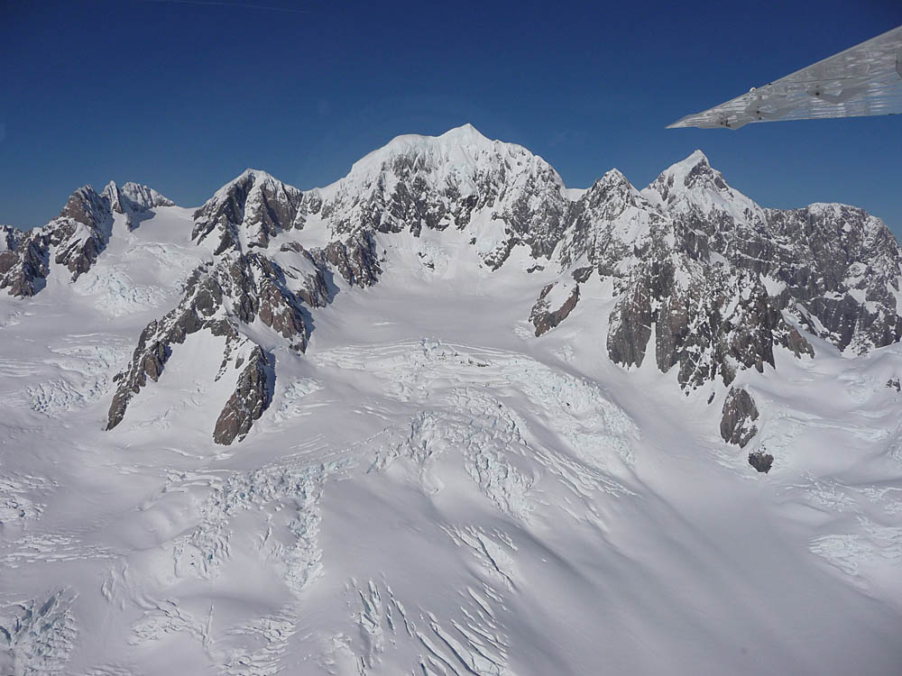
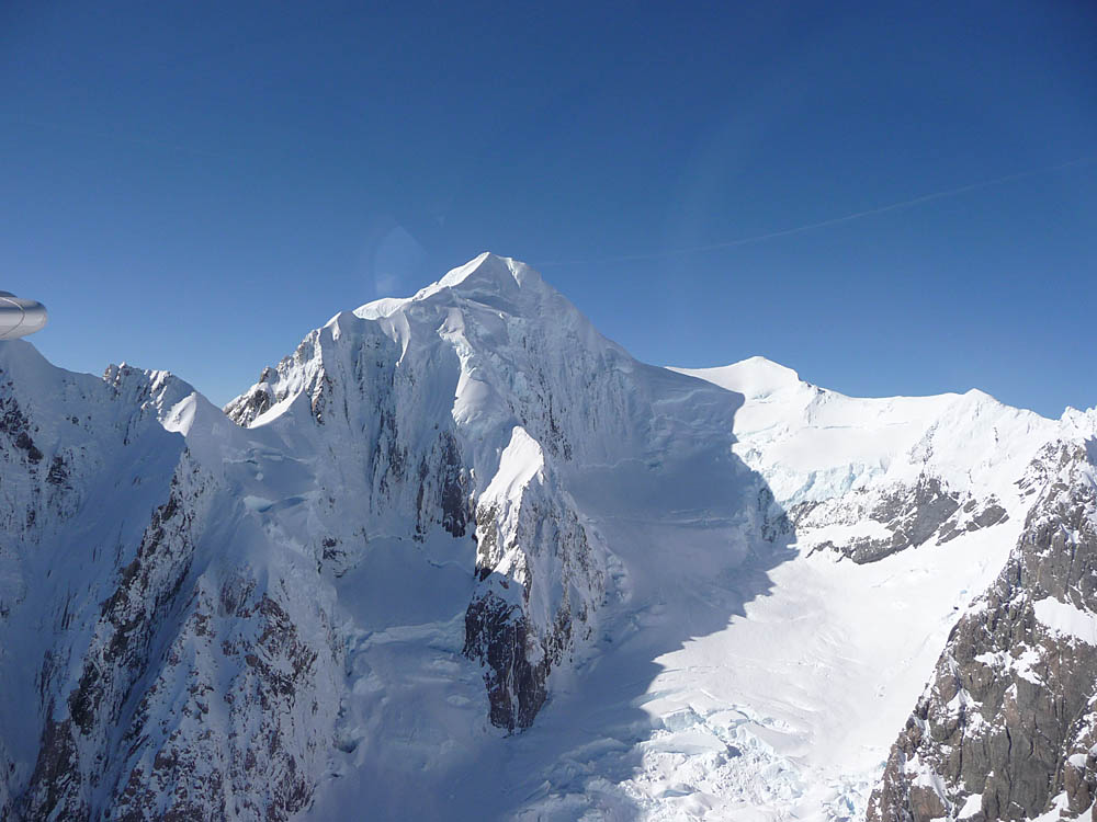
Mount Cook, at 12,371 ft. (3,754 m.) the highest mountain in New Zealand, was of course also on the itinerary. Indeed conditions were so good that the pilot lingered in the mountains, giving us a good hour of flight time before our final reluctant return to land.

A wonderful experience at the end of our New Zealand visit. The following day we headed back to Christchurch, spent a very pleasant evening with friends from England who emigrated some years previously, then flew out the following morning, August 2nd 2010. Only four weeks before September 4th when the first of a series of major earthquakes devastated the city. There were no fatalities at that time, later aftershocks causing 'only' structural damage. But on 22nd February 2011 a heavy aftershock killed 181 people, and two further quakes on June 13th 2011 caused one fatality and many injuries. We did not have time to visit the city centre with its beautiful architecture, alas now it will never be the same.
But at the time we left there was no inkling of what was to happen, and we looked forward to our next stop - Sydney