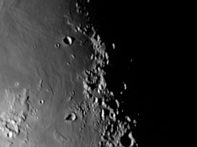
Sinus Asperitatis, south of Mare Tranquilitatis 
Move your mouse over the picture to see the names of the various craters.
|
This is the area to the far south of Mare Tranquilitatis where it runs into Sinus Asperitatis which is separated only by a low range of hills from Mare Nectaris. About the most interesting feature here is the rather odd shape of Torricelli. Close-up pictures from Apollo show that it really is this shape and don't (to me) look like a pair of overlapping craters. The substantial range of mountains on the terminator don't seem to have a name. They could be considered as the northernmost end of the Pyranees, but these mountains are the eastern borders of Mare Nectaris over 450 Km south east of here. In fairness the area looks much more like a mountain range here because of the terminator. It is really a mishmash of craters and rubble and hardly warrents the name of a mountain range.
The landing site of Apollo 11 is probably in this picture but I haven't tried to mark it.
The scale markers are approximately 50 Km north and west.
The picture was taken with a ToUcam attached to my LX200 on 10th December 2006 at 00:54 UT, when the Moon was 19.9 days old.
|
| Libration |
Latitude 0° 0', longitude 0° 0' |
| Solar inclination |
° |
| Lunar Phase |
° |
| Colongitude |
° |
| Date and Time |
UT |
| Camera |
|
| Telescope |
|
| Capture |
|
| Processing |
Gaussian wavelets Scheme 1 |
Home Back to SE Quadrant