Move your mouse over the picture to see the names of the various craters.
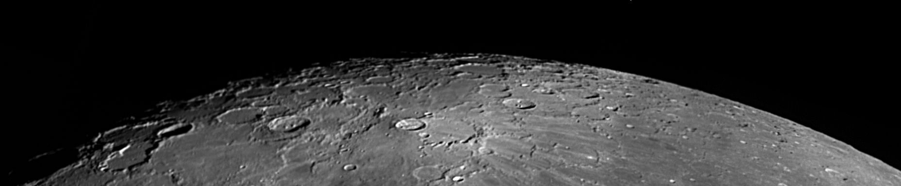
This image, a mosaic of four separate images, of the north, polar area was taken under almost ideal conditions. The libration in latitude was 5° 48' which is only about a degree less than the maximum it can be, and the solar inclination was 1.5° which is as large as it can ever be. This means that the edge of the visible disk beyond the north pole is the terminator not the limb, so that a greater libration would not have shown any more beyond the pole, but it was enough just to catch the far side of crater Hermite, which is centred at longitude 87.3° west and latitude 86.4° north, and all of Nansen at Longitude 95.3° east and latitude 81.3° north. The north pole itself lies in a very rugged area just north of the rim of Peary.
Scale markers are rather pointless in a picture of this area.
Both the direction of north and the scale change considerably with position. As a guide, some of the more-prominent craters have the following diameters:
Anaxogorus 53 Km, Philolaus 73 Km, Carpenter 70 Km, Byrd 97 Km, Peary 77 Km, Nansen 122 Km.
The picture was taken with a DMK 21AF04 attached to my LX200 on 27th March 2010 at about 23:13 UT,
when the Moon was 12.3 days old, and the colongitude was 61.2°.
Further pictures of this area can be found here.
This is the full-sized picture. Use Back on your browser to return to the previous previous page.
| Date and Time |
27th March 2010 23:10 to 23:16 UT |
Camera |
DMK 21AF04 |
Telescope |
LX200 at prime focus with Astronomik OIII filter (500 nm) |
Capture |
ICcapture. Low gamma, 1/120" 60 fps, gain 856, ~3000 frames |
Processing |
Registax. Multi-point alignment. Wavelet 1-2 = 10, gamma 0.8
Mosaic assembled in iMerge. |
Home Back to Crater Index